Wilson County

Wilson County, Texas

Wilson County, Texas
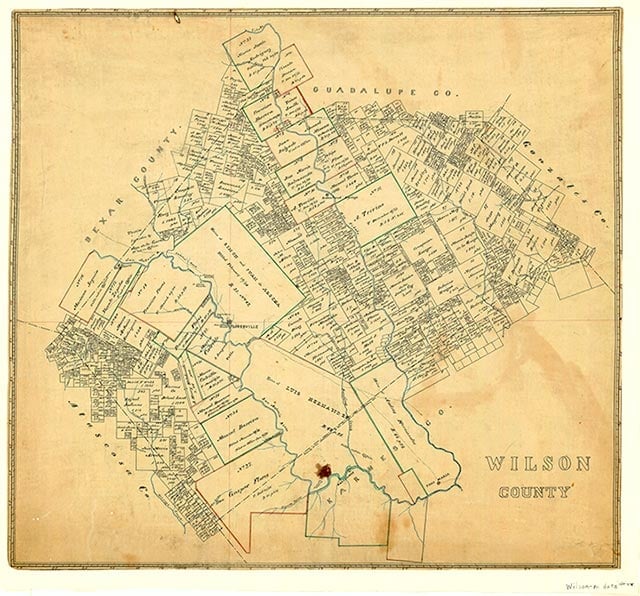
Wilson County is on the upper coastal plain of South Texas. The county seat and largest city is Floresville, which is thirty miles southeast of San Antonio. Four major highways serve the county, U.S. highways 87 and 181 and State highways 97 and 123. Wilson County covers 807 miles with an elevation of 300 to 600 feet above sea level. The terrain is nearly flat to gently undulating, surfaced by deep loamy soils with clayey subsoils that support grasses, mesquite, blackjack, post oak, live oak, thorny shrubs, and cacti. Between 31 and 40 percent of the land in the county is considered prime farmland. The western portion of the county is drained by the San Antonio River, the eastern portion by Cibolo and Ecleto creeks. The climate is subtropical subhumid, with mild winters and warm summers. Temperatures in January range from an average low of 40° to an average high of 65° F and in July range from 74° to 96° F. The growing season averages 280 days per year, with the last freeze in February and the first freeze in early December. Crops include peanuts, hay, sorghum, oats, wheat, corn, watermelons, peaches, and pecans.
The area that now comprises Wilson County has been the site of human habitation for several millennia. Archeological evidence reveals that hunter-gatherer Indians of the Coahuiltecan linguistic family occupied the region for several thousand years prior to the arrival of Europeans in the sixteenth century. The area was also in the hunting range of Comanche, Tonkawa, and Lipan-Apache Indians. The first Europeans to reach the territory were Spanish explorers, who traveled through the area in the early eighteenth century. In September 1718 Martín de Alarcón crossed the area on his way to explore the bay of Espíritu Santo, and in 1727 Pedro de Rivera y Villalón went north across the territory on his tour of inspection between La Bahía and Bexar. In 1766–67 the Marqués de Rubí included the area in his inspection of the Spanish frontier, and the 1798 explorations of the coast by Francisco Vázquez de Coronado probably crossed the territory. Ranchers from nearby San Antonio began grazing cattle in the region in the first half of the eighteenth century, and temporary settlements for vaqueros and herdsmen began around the middle of the century. The first two land grants in the area were to Luis Menchaca and Andrés Hernández, who established ranches extending across the southern portion of the present county. County land was also traversed from the northwest to the southeast by La Bahía Road, a major travel route from the Alamo to the Nuestra Señora del Espíritu Santo de Zúñiga Mission at Goliad. Later, this route served as a major road for cattle drives and transportation. Permanent settlement in the area began before 1830. Francisco Flores de Abreyo established his hacienda six miles northwest of the site of present Floresville; Manuel Barrera secured a land grant in 1833; Juan and Simón Arocha settled in 1834; Juan José María Erasmo Seguin built a home two or three miles from the site of Floresville in the later 1830s. In the immediate vicinity of the Flores ranch were the ranches of Chapoya, Pataguilla, Cabras, and Las Mulas; several other ranches were located along Cibolo Creek.
Christopher Long | © TSHA
Adapted from the official Handbook of Texas, a state encyclopedia developed by Texas State Historical Association (TSHA). It is an authoritative source of trusted historical records.
- ✅ Adoption Status:
Currently Exists
Yes
Place type
Wilson County is classified as a County
Altitude Range
300 ft – 804 ft
Size
Land area does not include water surface area, whereas total area does
- Land Area: 803.7 mi²
- Total Area: 808.4 mi²
Temperature
January mean minimum:
37.2°F
July mean maximum:
95.5°F
Rainfall, 2019
29.1 inches
Population Count, 2019
51,070
Civilian Labor Count, 2019
24,305
Unemployment, 2019
6.8%
Property Values, 2019
$4,826,652,935 USD
Per-Capita Income, 2019
$44,255 USD
Retail Sales, 2019
$535,309,227 USD
Wages, 2019
$98,791,411 USD
County Map of Texas
Wilson County
- Wilson County
Places of Wilson County
| Place | Type | Population (Year/Source) | Currently Exists |
|---|---|---|---|
| Town | – | – | |
| Town | – | – | |
| Town | – | – | |
| Town | – | – | |
| Town | 100 (2009) | Yes | |
| Town | 40 (2009) | Yes | |
| Town | – | – | |
| Town | – | – | |
| Town | 52 (2009) | Yes | |
| Town | 60 (2009) | Yes | |
| Town | – | – | |
| Town | 95 (2009) | Yes | |
| Town | 7,554 (2021) | Yes | |
| Town | – | – | |
| Town | – | – | |
| Town | 85 (2009) | Yes | |
| Town | – | – | |
| Town | – | – | |
| Town | 190 (2009) | Yes | |
| Town | 390 (2009) | Yes | |
| Town | 1,154 (2021) | Yes | |
| Town | – | – | |
| Town | – | – | |
| Town | – | – | |
| Town | 50 (2009) | Yes | |
| Town | – | – | |
| Town | – | – | |
| Town | – | – | |
| Town | – | – | |
| Town | – | – | |
| Town | – | – | |
| Town | – | – | |
| Town | 2,355 (2021) | Yes | |
| Town | 20 (2009) | Yes | |
| Town | – | – | |
| Town | 110 (2009) | Yes | |
| Town | – | – | |
| Town | – | – | |
| Town | 1,866 (2021) | Yes | |
| Town | – | – | |
| Town | 300 (2009) | Yes | |
| Town | – | – | |
| Town | 1,435 (2021) | Yes | |
| Town | – | – | |
| Town | 100 (2009) | Yes | |
| Town | 420 (2009) | Yes | |
| Town | 150 (2009) | Yes | |
| Town | – | – | |
| Town | – | – | |
| Town | – | – | |
| Town | 52 (2009) | Yes | |
| Town | – | – | |
| Town | – | – | |
| Town | – | – |
Proud to call Texas home?
Put your name on the town, county, or lake of your choice.
Search Places »