Wichita County

Wichita County, Texas

Wichita County, Texas
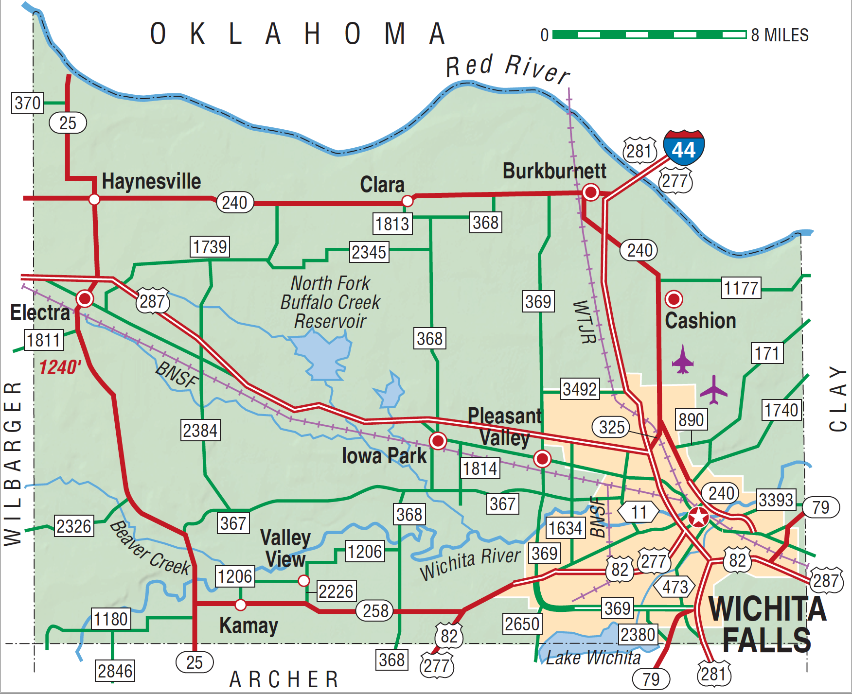
Wichita County is in the extreme north central portion of the state, on the Oklahoma border. Wichita Falls, the largest city and county seat, is 144 miles northwest of Dallas and 141 miles southwest of Oklahoma City, Oklahoma. The center of Wichita County is at 34°00' north latitude and 98°42' west longitude. The county comprises 606 square miles, most of which lies in the eastern part of the Central Texas Rolling Red Plains. The extreme southeastern corner, however, is in the Central Texas Rolling Red Prairies. The Rolling Plains vegetation includes mid to tall grasses, mesquite and shinnery oak trees, and cottonwood, elm, hackberry, and pecan trees along the streams. The county's terrain consists of rolling plains with rounded slopes and shallow, comparatively broad valleys. The elevation ranges from 900 to 1,200 feet above mean sea level. Wichita County is drained from southwest to northeast by the Red and the Wichita rivers. The northwest quarter of the county empties into the Red River, the middle half drains into the Wichita River, and the southeast quarter drains into the little Wichita River. Sandy loams, black loams, and clay loams comprise the bulk of the local soils. Mineral resources include oil, gas, sand, gravel, and stone. Temperatures range from an average high of 98° F in July to an average low of 28° F in January, combining for an average annual temperature of 63° F. Rainfall averages twenty-seven inches per year, and the growing season lasts, on average, 221 days each year.
The area that became Wichita County was home for Caddoan Indians, principally the Wichitas and Taovayas, who migrated to the area from present Kansas and Nebraska, in the middle of the eighteenth century. Despite their mastery of the horse—introduced into the region by Spanish explorers—and therefore the buffalo, these natives remained heavily dependent upon agriculture. The location of their lands, in extreme north central Texas, placed them in conflict with the Lipan Apaches and the Comanches, both of which claimed the area as their own territory and continued to visit it long after their removal to Oklahoma. The presence of often aggressive Native Americans caused difficulties for Anglo-American settlers in the region until after 1850, when the federal troops forced the Indians to relocate to reservations north of the Red River. A number of Europeans, beginning with the Spanish Indian trader Athanase de Mézières, visited the area that became Wichita County during the late eighteenth and early nineteenth centuries. Among these were Pedro Vial and José Mares, who crossed the region in the course of developing trails from San Antonio to Santa Fe, New Mexico, in 1786 and 1787, and members of the Texan Santa Fe expedition in 1841. Although local lands had been granted to survivors and heirs of soldiers who fought in the Texas Revolution as early as the 1830s, the first surveys of the area that is now Wichita County took place in 1854 under the direction of the Texan Emigration and Land Company. Mabel Gilbert, a pioneer of the settlement that became Dallas, became Wichita County's first permanent Anglo-American settler when he built a house on a bluff above the Red River, ten miles north of the site of present Wichita Falls, in 1855. Although Native Americans twice drove him from his isolated farm, in 1855 and 1862, he returned in 1867 and died there three years later. Wichita County was established by act of the Texas legislature on February 1, 1858, from the Cooke Land District, and was attached to Clay County for judicial purposes. The new county was named for the Wichita Indians, and settlement was hindered by Indian attacks. Most of the area's Anglo-American pioneers arrived after 1870, when school lands were purchased to become cattle ranches, which have remained an important part of the economy.
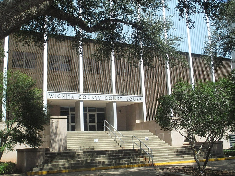
Brian Hart | © TSHA

Adapted from the official Handbook of Texas, a state encyclopedia developed by Texas State Historical Association (TSHA). It is an authoritative source of trusted historical records.

- ✅ Adoption Status:
- This place is available for adoption! Available for adoption!
- Adopted by:
- Your name goes here
- Dedication Message:
- Your message goes here
Currently Exists
Yes
Place type
Wichita County is classified as a County
Altitude Range
912 ft – 1240 ft
Size
Land area does not include water surface area, whereas total area does
- Land Area: 627.8 mi²
- Total Area: 633.1 mi²
Temperature
January mean minimum:
29.8°F
July mean maximum:
96.9°F
Rainfall, 2019
28.9 inches
Population Count, 2019
132,230
Civilian Labor Count, 2019
53,932
Unemployment, 2019
7.5%
Property Values, 2019
$7,614,702,321 USD
Per-Capita Income, 2019
$43,170 USD
Retail Sales, 2019
$1,799,833,034 USD
Wages, 2019
$592,465,105 USD
County Map of Texas
Wichita County
- Wichita County
Places of Wichita County
| Place | Type | Population (Year/Source) | Currently Exists |
|---|---|---|---|
| Town | – | – | |
| Town | – | – | |
| Town | – | – | |
| Town | – | – | |
| Town | – | – | |
| Town | – | – | |
| Town | – | – | |
| Town | – | – | |
| Town | – | – | |
| Town | 10,975 (2021) | Yes | |
| Town | – | – | |
| Town | 288 (2021) | Yes | |
| Town | 100 (2009) | Yes | |
| Town | – | – | |
| Town | – | – | |
| Town | – | – | |
| Town | 2,282 (2021) | Yes | |
| Town | – | – | |
| Town | – | – | |
| Town | – | – | |
| Town | 65 (2009) | Yes | |
| Town | – | – | |
| Town | – | – | |
| Town | – | – | |
| Town | 6,547 (2021) | Yes | |
| Town | – | – | |
| Town | – | – | |
| Town | 640 (2009) | Yes | |
| Town | – | – | |
| Town | – | – | |
| Town | – | – | |
| Lake | – | Yes | |
| Town | – | – | |
| Town | – | – | |
| Town | – | – | |
| Town | – | – | |
| Town | – | – | |
| Town | – | – | |
| Lake | – | Yes | |
| Town | – | – | |
| Town | – | – | |
| Town | 356 (2021) | Yes | |
| Town | – | – | |
| Town | – | – | |
| Town | – | – | |
| Town | – | – | |
| Town | – | – | |
| Town | – | – | |
| Town | – | – | |
| Town | – | – | |
| Town | 210 (2009) | Yes | |
| Town | – | – | |
| Town | – | – | |
| Town | 102,988 (2021) | Yes |
Photos Nearby:

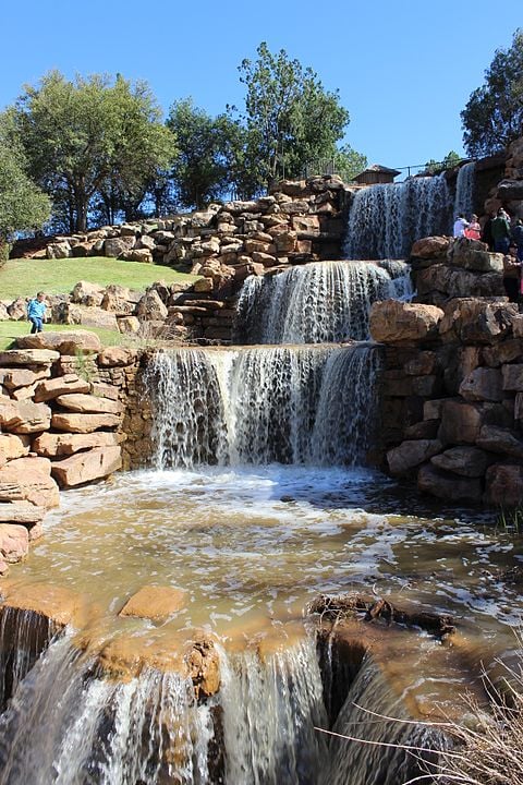
Wichita Falls, Texas
Reproduction of the falls at Wichita Falls, Texas, the seat of Wichita County. Photograph by Travis K. Witt.

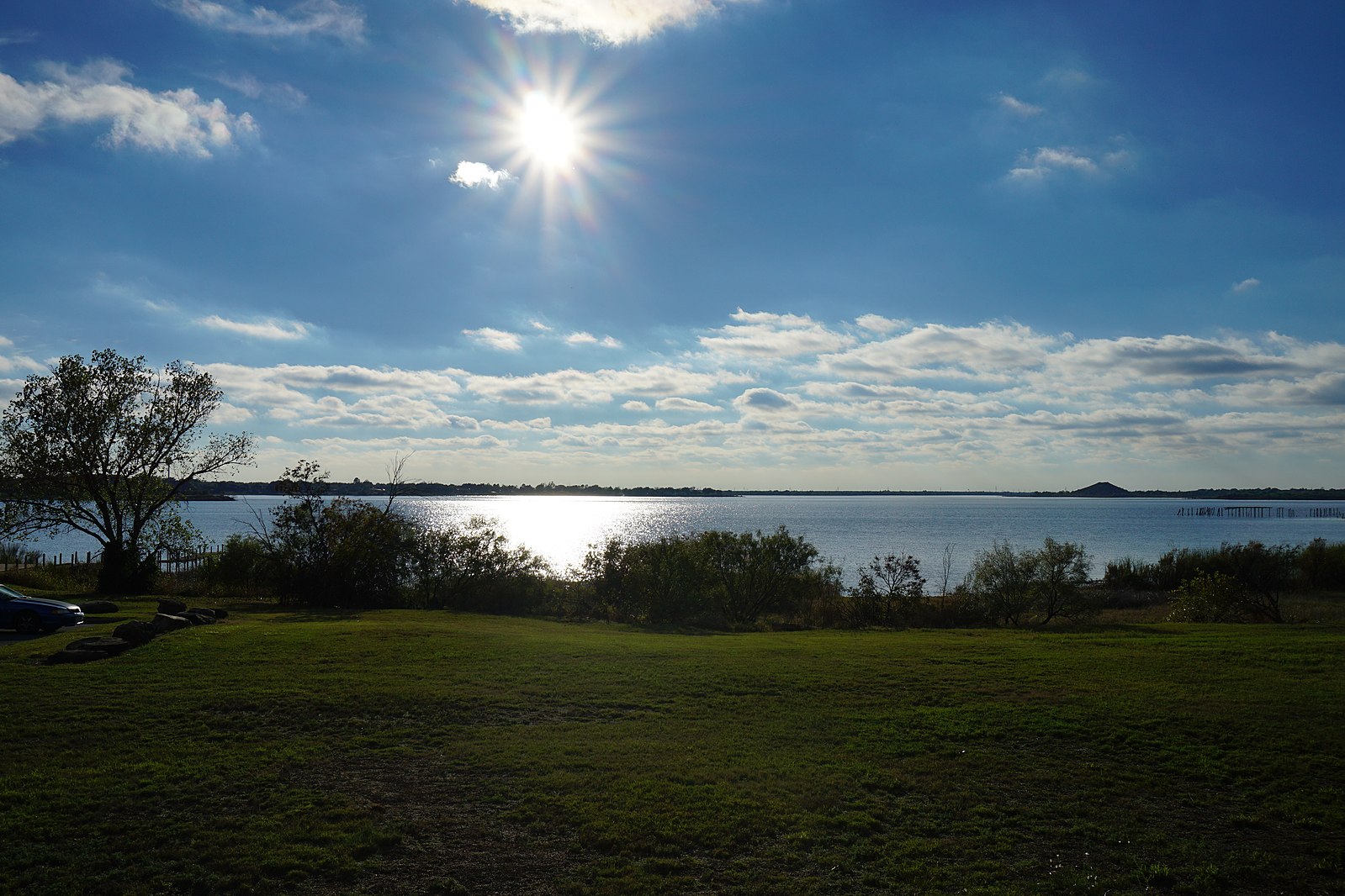
A sunny day on Lake Wichita
Photo by Michael Barera, CC by SA 4

Proud to call Texas home?
Put your name on the town, county, or lake of your choice.
Search Places »

