Parmer County

Parmer County, Texas

Parmer County, Texas
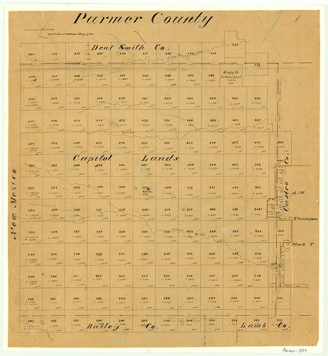
Parmer County, on the western border of the Panhandle of Texas, is bordered on the west by New Mexico, on the north by Deaf Smith County, on the east by Castro County, and on the south by Bailey and Lamb counties. The county is on the High Plains of Texas, and its center is located at 34°33' north latitude and 102°47' west longitude. Farwell, the county seat, is on the Texas-New Mexico border, fifteen miles southwest of the center of the county and eighty-five miles southwest of Amarillo. The county was named for Martin Parmer, an early settler and Texas Revolution veteran. Parmer County occupies 859 square miles of level plains surfaced by sandy, clay, and loam soils. These soils support some native grasses, but now the land is largely cultivated and produces abundant corn, sugar beets, and potatoes, as well as sorghums, cotton, wheat, hay, and soybeans. The elevation ranges from 3,800 to 4,202 feet above sea level, and the county is bisected from northwest to southeast by Running Water Draw, an intermittent but flood-prone creek. Lesser dry arroyos, such as Catfish Draw and Frio Draw, also serve to break the level plains in some areas. Rainfall averages 17.50 inches per year. The average annual minimum temperature is 21° F in January, and the average maximum is 92° F in July. The growing season averages 183 days per year.
The region including Parmer County has remained rather isolated throughout its history. It is possible that the José Mares expedition from Santa Fe to San Antonio crossed the northeastern corner of the county in 1787, but for the most part the region remained under the control of its aboriginal inhabitants. Apaches occupied the Panhandle-Plains until they were pushed out around 1700 by the Kiowas and Comanches, who ruled the Texas High Plains between 1700 and the end of the Red River War in 1874. After their defeat and removal to Indian Territory, the Parmer County region was opened for White settlement.
Donald R. Abbe | © TSHA
Adapted from the official Handbook of Texas, a state encyclopedia developed by Texas State Historical Association (TSHA). It is an authoritative source of trusted historical records.
- ✅ Adoption Status:
- This place is available for adoption! Available for adoption!
- Adopted by:
- Your name goes here
- Dedication Message:
- Your message goes here
Currently Exists
Yes
Place type
Parmer County is classified as a County
Altitude Range
3785 ft – 4440 ft
Size
Land area does not include water surface area, whereas total area does
- Land Area: 880.8 mi²
- Total Area: 885.2 mi²
Temperature
January mean minimum:
22.5°F
July mean maximum:
89.8°F
Rainfall, 2019
20.1 inches
Population Count, 2019
9,605
Civilian Labor Count, 2019
4,433
Unemployment, 2019
2.9%
Property Values, 2019
$1,620,263,705 USD
Per-Capita Income, 2019
$44,981 USD
Retail Sales, 2019
$93,554,191 USD
Wages, 2019
$69,778,460 USD
County Map of Texas
Parmer County
- Parmer County
Places of Parmer County
| Place | Type | Population (Year/Source) | Currently Exists |
|---|---|---|---|
| Town | 100 (2009) | Yes | |
| Town | 1,703 (2021) | Yes | |
| Town | – | – | |
| Town | 15 (2009) | Yes | |
| Town | 1,389 (2021) | Yes | |
| Town | 4,144 (2021) | Yes | |
| Town | 25 (2009) | Yes | |
| Town | – | – | |
| Town | 100 (2009) | Yes | |
| Town | 248 (2009) | Yes | |
| Town | 25 (2009) | Yes | |
| Town | – | – | |
| Town | 98 (2009) | Yes | |
| Town | – | – | |
| Town | – | – |
Photos Nearby:

Friona, Texas
Gorgeous view of the town of Friona at dusk, in Parmer County, Texas. Photograph by Charles Henry.

Farwell, Texas
Photograph of the Farwell City Hall, in the seat of Parmer County, Texas. Photograph by Larry D. Moore.

Bovina, Texas
Shot of a landmark grain elevator in the town of Bovina, Texas. Photograph by Leaflet.
Proud to call Texas home?
Put your name on the town, county, or lake of your choice.
Search Places »