Nueces County

Nueces County, Texas

Nueces County, Texas
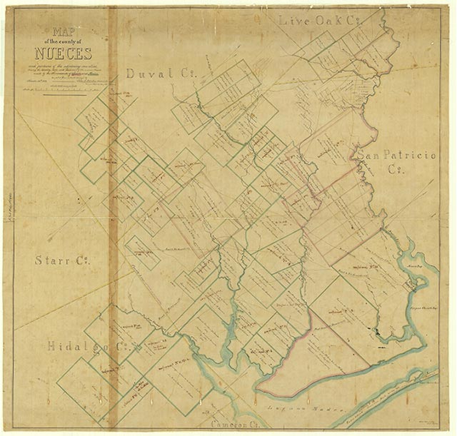
Nueces County is on the Gulf of Mexico southeast of San Antonio. It is bounded on the north by the Nueces River and on the east by the Laguna Madre, Corpus Christi Bay, and Redfish Bay. San Patricio County is on the north border, Jim Wells County on the west, and Kleberg County on the south. The county seat and largest city, Corpus Christi, is 210 miles southwest of Houston and 145 miles southeast of San Antonio. The center of the county lies roughly at 27°44' north latitude and 97°33' west longitude. Two major highways serve the county, Interstate 37 and U.S. Highway 77. Two railroads, the Missouri Pacific and the Texas-Mexican, cross the county.
Nueces County comprises 847 square miles of the Coastal Prairies region. The terrain is generally flat. The elevation ranges from sea level to 180 feet above sea level. In the central part of the county the soil varies from very dark loams to gray or black cracking clayey soils. In the west the soils are light to dark with loamy surfaces and clayey subsoils. In the coastal region the soils are sandy; in marsh areas the soils are also very dark with clayey subsoils. Vegetation varies from cordgrasses, salt grasses, and marsh millet along the coast to tall grasses, oak, prickly pear, acacias, and mesquite trees in the central and western parts of the county. Between 61 and 70 percent of the land in the county is considered prime farmland. The Nueces River drains the northern and western portions of the county, Oso Creek the central portion, and San Fernando and Petronila creeks the southern portion. The climate is humid-subtropical. Temperatures range from an average high of 93° F in July to an average low of 47° in January. The average annual rainfall is thirty inches. The growing season extends for an annual average of 309 days, with the first freeze in December and the last in early February. Crops include sorghum, cotton, hay, corn, wheat, watermelons, peaches, and pecans. Beef and dairy cattle and hogs are raised.
Christopher Long | © TSHA
Adapted from the official Handbook of Texas, a state encyclopedia developed by Texas State Historical Association (TSHA). It is an authoritative source of trusted historical records.
- ✅ Adoption Status:
Currently Exists
Yes
Place type
Nueces County is classified as a County
Altitude Range
0 ft – 150 ft
Size
Land area does not include water surface area, whereas total area does
- Land Area: 838.5 mi²
- Total Area: 1,165.6 mi²
Temperature
January mean minimum:
46.6°F
July mean maximum:
93.1°F
Rainfall, 2019
32.5 inches
Population Count, 2019
362,294
Civilian Labor Count, 2019
163,183
Unemployment, 2019
10.0%
Property Values, 2019
$35,948,645,399 USD
Per-Capita Income, 2019
$44,378 USD
Retail Sales, 2019
$5,555,317,993 USD
Wages, 2019
$2,106,085,395 USD
County Map of Texas
Nueces County
- Nueces County
Places of Nueces County
| Place | Type | Population (Year/Source) | Currently Exists |
|---|---|---|---|
| Town | 688 (2021) | Yes | |
| Town | – | – | |
| Town | – | Yes | |
| Town | – | – | |
| Town | 425 (2021) | Yes | |
| Town | – | – | |
| Town | 3,155 (2021) | Yes | |
| Town | 150 (2009) | Yes | |
| Town | – | – | |
| Town | – | Yes | |
| Town | – | – | |
| Town | 200 (2009) | Yes | |
| Town | – | – | |
| Town | – | – | |
| Town | – | – | |
| Town | – | – | |
| Town | 317,773 (2021) | Yes | |
| Town | 673 (2021) | Yes | |
| Town | – | – | |
| Town | – | – | |
| Town | – | Yes | |
| Town | – | – | |
| Town | – | – | |
| Town | – | – | |
| Town | – | – | |
| Town | – | – | |
| Town | – | – | |
| Town | 670 (2021) | Yes | |
| Town | – | – | |
| Town | – | – | |
| Town | – | – | |
| Town | – | – | |
| Town | – | – | |
| Town | – | – | |
| Town | – | – | |
| Town | – | – | |
| Town | – | – | |
| Town | 752 (2021) | Yes | |
| Town | – | – | |
| Town | – | – | |
| Town | – | – | |
| Town | – | – | |
| Town | 87 (2021) | Yes | |
| Town | 3,105 (2021) | Yes | |
| Town | – | – | |
| Town | – | – | |
| Town | 517 (2021) | Yes | |
| Town | – | – | |
| Town | – | – | |
| Town | 10,157 (2021) | Yes | |
| Town | – | – | |
| Town | – | – | |
| Town | – | – | |
| Town | 571 (2021) | Yes | |
| Town | – | – | |
| Town | – | – | |
| Town | – | – | |
| Town | 489 (2021) | Yes | |
| Town | – | – | |
| Town | – | – | |
| Town | – | – | |
| Town | – | – | |
| Town | 185 (2021) | Yes | |
| Town | 232 (2021) | Yes | |
| Town | – | – | |
| Town | – | – | |
| Town | – | – | |
| Town | 160 (2009) | Yes | |
| Town | – | – | |
| Town | – | – |
Photos Nearby:

Port Aransas, Texas
The Tarpoon Inn is listed on the National Register of Historic Places and a landmark of Port Aransas, in Nueces County, Texas. Photograph by Larry D. Moore.

Corpus Christi, Texas
Corpus Christi, Texas Photo by Joshua J. Cotten on Unsplash

Agua Dulce, Texas
Agua Dulce, Texas on Map. Photograph by25or6to4.
Proud to call Texas home?
Put your name on the town, county, or lake of your choice.
Search Places »