Newton County

Newton County, Texas

Newton County, Texas
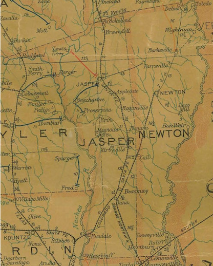
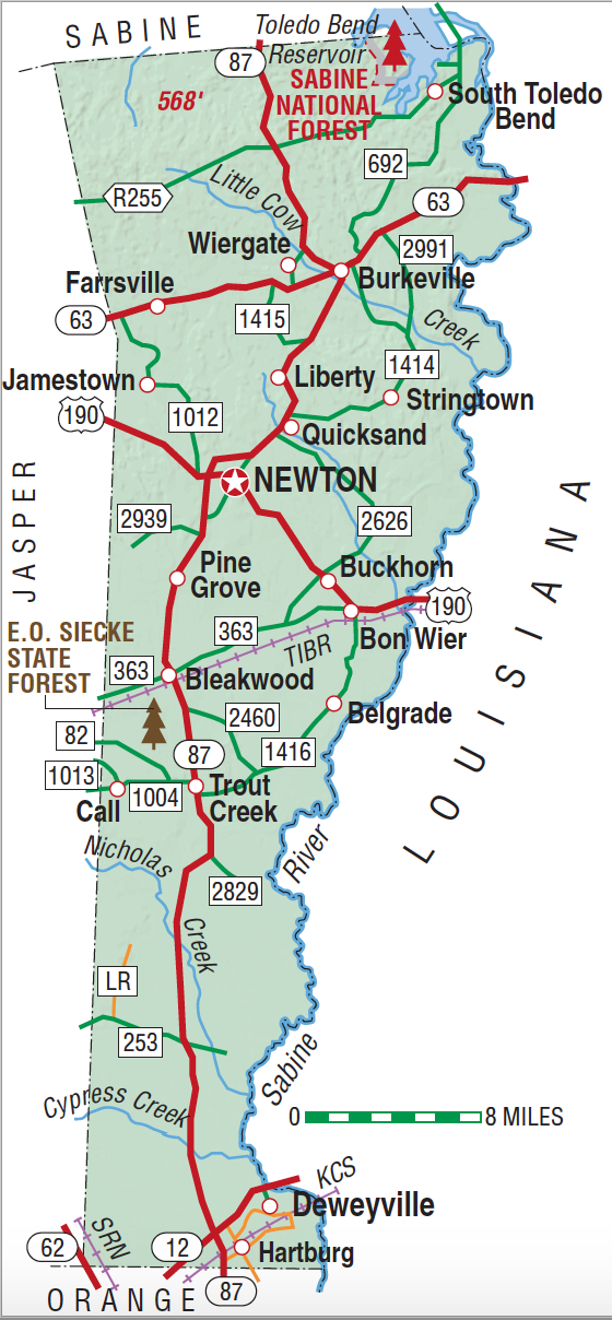
Newton County is in southeastern Texas on the Louisiana border. Newton, the geographic center and largest town of the county, is seventy miles northeast of Beaumont at 30°51' north latitude and 93°45' west longitude. Newton County comprises 950 square miles of the lower regions of the East Texas timber belt. Common trees include longleaf and shortleaf pines, oak, magnolia, hickory, and cypress. The rolling terrain, dominated by loamy topsoils, ranges from 30 to 300 feet above sea level. The Sabine River forms the county's eastern boundary. Major tributaries in the county include, from north to south, Little Cow Creek, Quicksand Creek, Big Cow Creek, and Big Cypress Creek. Oil and gas dominate the county's mineral resources. Temperatures range from an average high in July of 93° F to an average January low of 40° F. Rainfall averages just over fifty-four inches annually, the highest for any county in the state. The growing season extends for 228 days per year. Indians were the earliest human inhabitants of Newton County. Artifacts attributed to members of the Caddo confederacies have been located in present-day Newton County. The Atakapans, whose name means "man-eaters" in Choctaw, occupied the coastal regions around the Sabine River and may also have ventured into Newton County. The Coushattas, who migrated to lower East Texas during the early 1800s, also came through the county. In fact, one of the earliest trails through the area was known as the Coushatta Trace. The lands which eventually comprised Newton County were included in Lorenzo de Zavala's 1829 grant from the Mexican government. At least twenty-one settlers received title to land now in the county in 1834 and 1835. Most of the area of present-day Newton County was part of the Municipality of Liberty from 1831 to 1834 and the Municipality of Bevil, which later became Jasper County, from 1834 to 1846. The area north of the Little Cow Creek, which includes one-fifth of the present county, was within the Municipality of San Augustine in 1834–35 and the Municipality of Sabine from 1835 to 1837, before becoming part of Jasper County in 1837. The state legislature marked off Newton County on April 22, 1846, from the eastern half of Jasper County and named it in honor of John Newton, a veteran of the American Revolution. The county's boundaries have remained unchanged since that time save for a small cession along the western border to Jasper in 1852.
The issue of the location of the courthouse dominated Newton County's early history. Electors originally voted to place the seat at the center of the county, and the first commissioners' court meetings convened near Quicksand Creek as a result. However, citizens of Burkeville successfully petitioned the Texas legislature to make their town the county seat in 1848. Voters narrowly approved the new location the following year. In 1853 a dispute concerning land titles, followed by yet another election, resulted in the move of offices to Newton, a newly established community at the geographic center of the county. Burkeville citizens refused to give up the struggle, and an 1855 plebiscite favored Burkeville by a small majority. County officials refused to leave Newton, however, convincing the legislature to recognize that city as the proper seat of government, where it has since remained. By 1860 settlers in Newton County had established a mixed agricultural economy based on corn, potatoes, cattle, hogs, sheep, and horses. Cotton production had jumped from 152 bales in 1850 to 2,091 bales in 1860. Although there were few large planters, the number of slaves was also growing and in 1860 reached 1,103, 34 percent of the county's population. From a very early date Baptist and Methodists dominated the county's religious life.
Robert Wooster | © TSHA

Adapted from the official Handbook of Texas, a state encyclopedia developed by Texas State Historical Association (TSHA). It is an authoritative source of trusted historical records.

- ✅ Adoption Status:
- This place is available for adoption! Available for adoption!
- Adopted by:
- Your name goes here
- Dedication Message:
- Your message goes here
Currently Exists
Yes
Place type
Newton County is classified as a County
Altitude Range
10 ft – 568 ft
Size
Land area does not include water surface area, whereas total area does
- Land Area: 933.7 mi²
- Total Area: 939.7 mi²
Temperature
January mean minimum:
36.5°F
July mean maximum:
93.1°F
Rainfall, 2019
54.9 inches
Population Count, 2019
13,595
Civilian Labor Count, 2019
4,953
Unemployment, 2019
12.3%
Property Values, 2019
$2,226,290,841 USD
Per-Capita Income, 2019
$33,350 USD
Retail Sales, 2019
$32,958,484 USD
Wages, 2019
$12,113,232 USD
County Map of Texas
Newton County
- Newton County
Places of Newton County
| Place | Type | Population (Year/Source) | Currently Exists |
|---|---|---|---|
| Town | – | – | |
| Town | – | – | |
| Town | – | – | |
| Town | 20 (2009) | Yes | |
| Town | – | – | |
| Town | – | – | |
| Town | 75 (2009) | Yes | |
| Town | 450 (2009) | Yes | |
| Town | 375 (2009) | Yes | |
| Town | 80 (2009) | Yes | |
| Town | 90 (2009) | Yes | |
| Town | 603 (2009) | Yes | |
| Town | 493 (2009) | Yes | |
| Town | – | – | |
| Town | – | – | |
| Town | – | – | |
| Town | – | – | |
| Town | – | – | |
| Town | – | – | |
| Town | – | – | |
| Town | – | – | |
| Town | – | – | |
| Town | – | – | |
| Town | – | – | |
| Town | – | – | |
| Town | – | – | |
| Town | – | – | |
| Town | – | – | |
| Town | – | – | |
| Town | 519 (2021) | Yes | |
| Town | 152 (2009) | Yes | |
| Town | 183 (2009) | Yes | |
| Town | – | – | |
| Town | – | – | |
| Town | – | – | |
| Town | – | – | |
| Town | 893 (2009) | Yes | |
| Town | – | – | |
| Town | – | – | |
| Town | – | – | |
| Town | – | – | |
| Town | 7 (2009) | Yes | |
| Town | – | – | |
| Town | 196 (2009) | Yes | |
| Town | – | – | |
| Town | – | – | |
| Town | – | – | |
| Town | 357 (2009) | Yes | |
| Town | – | – | |
| Town | – | – | |
| Town | – | – | |
| Town | – | – | |
| Town | 128 (2009) | Yes | |
| Town | – | – | |
| Town | – | – | |
| Town | – | – | |
| Town | – | – | |
| Town | – | – | |
| Town | – | – | |
| Town | 50 (2009) | Yes | |
| Town | – | – | |
| Town | – | – | |
| Town | – | – | |
| Town | 1,991 (2021) | Yes | |
| Town | – | – | |
| Town | – | – | |
| Town | – | – | |
| Town | – | – | |
| Town | 180 (2009) | Yes | |
| Town | – | – | |
| Town | – | – | |
| Town | – | – | |
| Town | – | – | |
| Town | – | – | |
| Town | – | – | |
| Town | 50 (2009) | Yes | |
| Town | – | – | |
| Town | – | – | |
| Town | 218 (2009) | Yes | |
| Town | – | – | |
| Town | – | – | |
| Town | 25 (2011) | Yes | |
| Town | 35 (2009) | Yes | |
| Town | – | – | |
| Town | – | – | |
| Town | 337 (2021) | Yes | |
| Town | – | – | |
| Town | 20 (2009) | Yes | |
| Town | – | – | |
| Town | – | – | |
| Town | – | – | |
| Town | – | – | |
| Lake | – | Yes | |
| Town | – | – | |
| Town | 70 (2009) | Yes | |
| Town | – | – | |
| Town | – | – | |
| Town | – | – | |
| Town | – | – | |
| Town | 350 (2009) | Yes | |
| Town | – | – | |
| Town | – | – | |
| Town | – | – | |
| Town | – | – | |
| Town | – | – |
Photos Nearby:

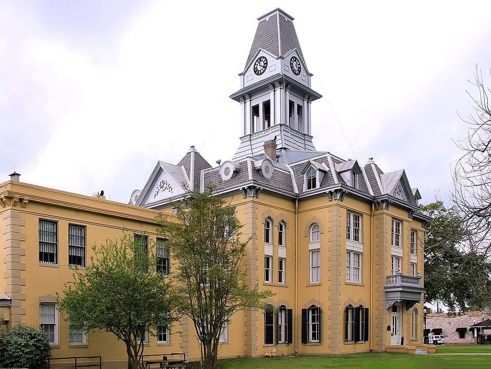
Newton, Texas
Newton is a city in and the seat of Newton County, Texas. Photograph by Larry D. Moore.

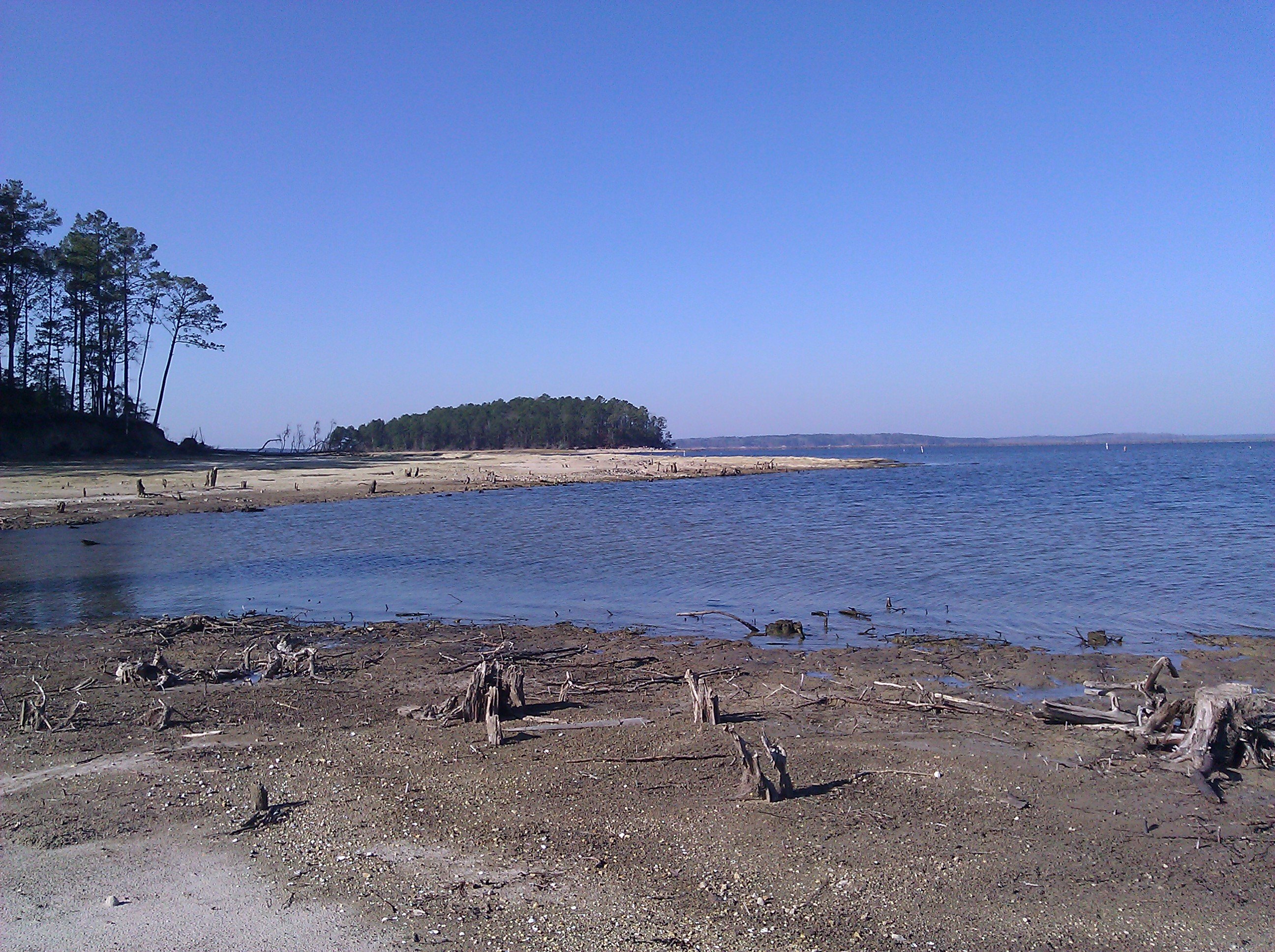
Toledo Bend Reservoir runs along the Texas–Louisiana border
Photo by Chrismiceli, Public Domain

Proud to call Texas home?
Put your name on the town, county, or lake of your choice.
Search Places »

