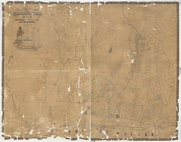
Matagorda County
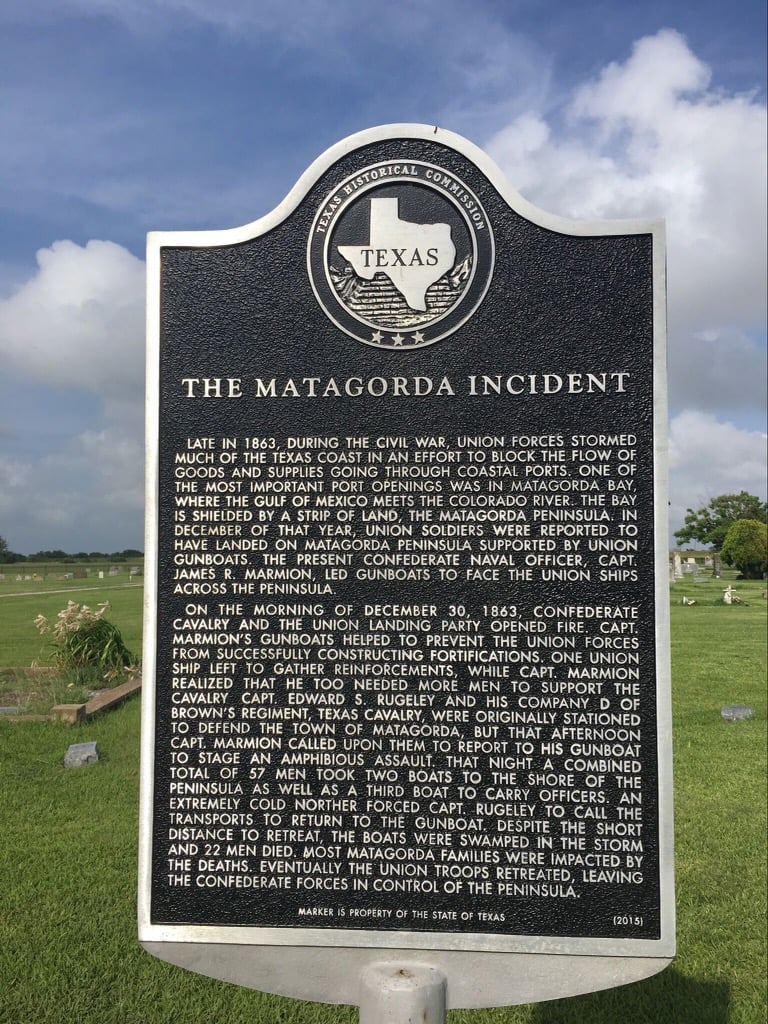
Matagorda County, Texas
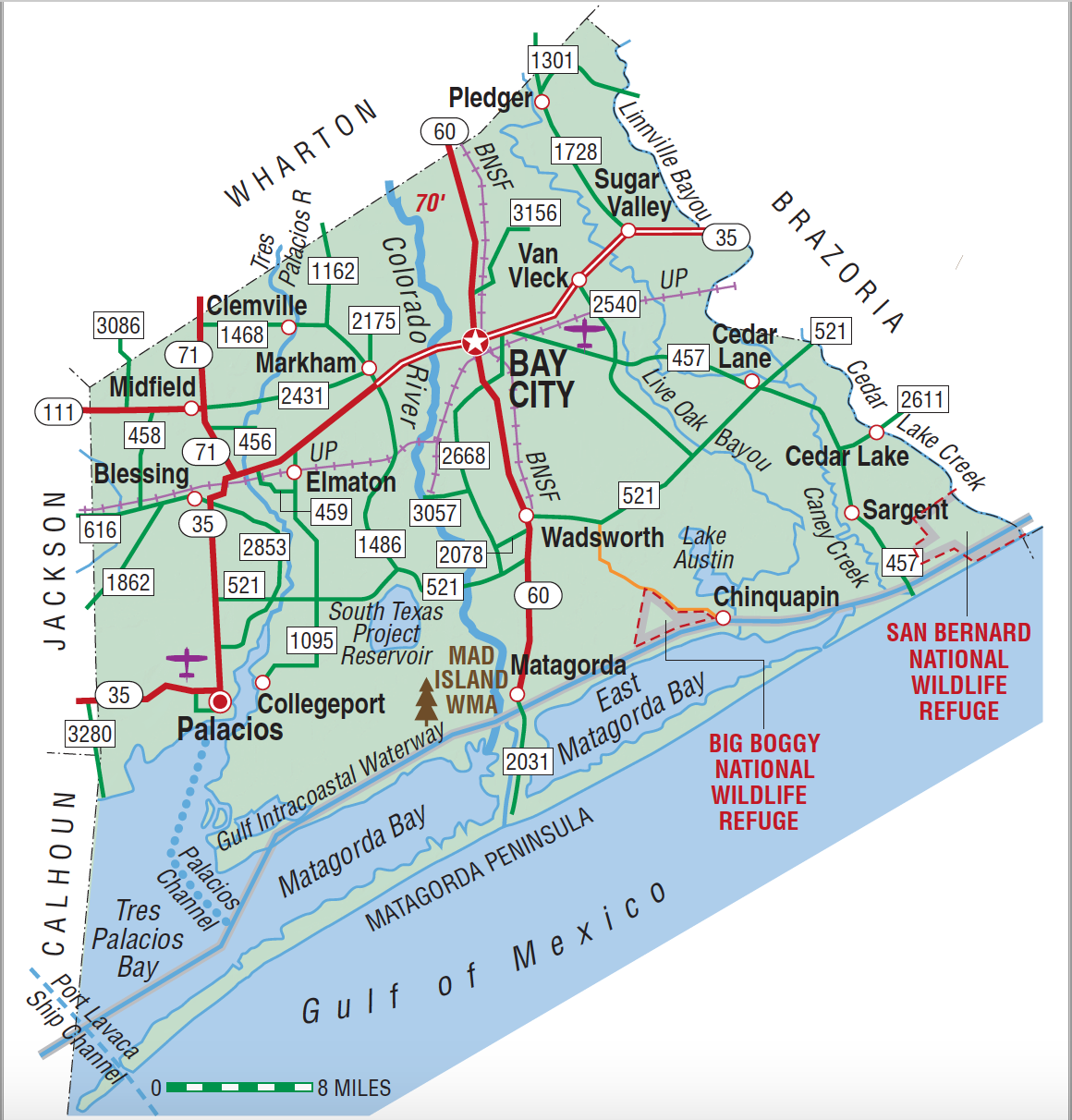
Matagorda County, Texas
Matagorda County is in the Coastal Prairie region of Texas, bounded on the north by Wharton County, on the east by Brazoria County and the Gulf of Mexico, on the west by Calhoun and Jackson counties, and on the south by the Gulf of Mexico and Tres Palacios, Matagorda, and East Matagorda bays. The center of the county lies at 28°54' north latitude and 95°59' west longitude; Bay City, the county's seat of government and largest city, is four miles north of the center of the county at the convergence of State highways 35 and 60, fifty air miles southwest of Houston. The name Matagorda, Spanish for "thick brush," was derived from the canebrakes that formerly lined the shore. Crossed by the once highly flood-prone Colorado River, which bisects it from north to south, the county extends across 1,612 square miles of mostly open prairie. With the exception of a slight undulation in the north, most of the county is level, with elevations ranging from sea level to seventy feet. Part of Matagorda Peninsula, a narrow barrier island formed less than 5,000 years ago, runs northeast and southwest for sixty-five miles from the mouth of Caney Creek in the eastern part of the county to Pass Cavallo on the west. The peninsula protects Matagorda Bay and is cut in half by the Colorado River channel twenty-four miles from the pass. Major watercourses in the county include Caney, Peach, Peyton's, Turtle, Cash's, and Big and Little Boggy creeks, the Trespalacios and Colorado rivers, Live Oak and Linville bayous, and Little Robbins Slough. Along the rivers the soils are brownish to reddish, cracking and clayey to loamy, and along the coast soils are sandy. In the rest of the county light-colored, shallow loam covers clayey subsoils; some areas, particularly in the coastal marshes, have gray to black, cracking, clayey soils. Temperatures in the county vary from an average low of 44° F in January to an average high of 92° F in July. The growing season averages 295 days per year. Live oak, post oak, pin oak, pecan, ash cottonwood, elm, red cedar, and mulberry grow in the county's forests; mesquite and prickly pear have invaded the Bay Prairie in patches where the land has been overgrazed. The area harbors a variety of wildlife, including bobcats, coyotes, otters, white-tailed deer, and numerous smaller mammals, as well as oysters, shrimp, fish, snakes, and waterfowl. A number of protected wildlife habitats, including Big Boggy National Wildlife Refuge, the Mad Island Wildlife Management Area, the Runnels Family Mad Island Marsh, and the Nature Conservance, are located in the county. The Colorado Barge Canal, completed in 1959, extends fifteen miles along the Colorado River from the Gulf Intracoastal Waterway to a turning basin below Bay City and links the county to deep water at Freeport and Galveston. In the early 20th century, the county was served by the Union Pacific and Burlington Northern Santa Fe railroads.
Archeological research has revealed a pattern of relatively dense occupation near inland water sources in the upper Texas coastal region, and projectile points from the early Paleo-Indian period (10,000–6,000 B.C.) have been found thinly scattered along the Texas coastal plain. By the time of European exploration in the early 1500s, the central section of the Texas coast, including Matagorda County, was home to several linguistically related subgroups of the hunter-gatherer Karankawa Indians. By the eighteenth and nineteenth centuries the shifting of tribal territories further north forced other tribes, notably the Tonkawa Indians of Central Texas, toward the coast and into Karankawa territory. Alonso Álvarez de Pineda mapped the Texas coastline in 1519, but the first recorded European expedition into the Texas interior was conducted by Álvar Núñez Cabeza de Vaca, who sometime after 1528 probably passed through what later became Matagorda County. Guido de Lavazares landed at Matagorda Bay in 1558, surveyed the northern Gulf Coast, and claimed the area for King Charles V. In 1690 Manuel José de Cárdenas y Magaña mapped Matagorda Bay as part of the Llanos-Cárdenas expedition, and the Alarcón expedition passed through what is now Matagorda County between 1718 and 1719. As early as 1820 plans were made to establish a port at the site of the future town of Matagorda, but none developed, since silt deposited in the bay by the Colorado River made a port impractical at that time. Settlement by Anglo-Americans began in 1822, when the schooner Only Son landed immigrants for Stephen F. Austin's colony at the mouth of the Colorado. Some of the first White residents of what is now Matagorda County were soldiers sent to protect the new settlers from the Karankawa Indians. Austin gave grants in the area to fifty-two families, principally from New York, and in 1827 received permission to settle 300 more within thirty leagues of the coast in areas where settlement had previously been forbidden by the Mexican government. The town of Matagorda, at the mouth of the Colorado River, was founded in 1829 after Austin had convinced the Mexican government that a military post was needed to protect incoming settlers. The town quickly flourished, and settlement proceeded inward from the coast, initially along Caney Creek. A custom house established at Matagorda in 1831 was maintained until the Texas Revolution. Steamers and sailing vessels approached within six miles of the town on Matagorda Bay; other county transportation was also largely by water. The municipality of Matagorda, which comprised the southeast corner of the original Austin grants, was established in 1834 while the area remained under Mexican control.
Diana J. Kleiner | © TSHA

Adapted from the official Handbook of Texas, a state encyclopedia developed by Texas State Historical Association (TSHA). It is an authoritative source of trusted historical records.

- ✅ Adoption Status:
Currently Exists
Yes
Place type
Matagorda County is classified as a County
Altitude Range
0 ft – 70 ft
Size
Land area does not include water surface area, whereas total area does
- Land Area: 1,100.3 mi²
- Total Area: 1,612.5 mi²
Temperature
January mean minimum:
45.4°F
July mean maximum:
91.5°F
Rainfall, 2019
48.9 inches
Population Count, 2019
36,643
Civilian Labor Count, 2019
16,628
Unemployment, 2019
11.5%
Property Values, 2019
$7,512,749,439 USD
Per-Capita Income, 2019
$40,596 USD
Retail Sales, 2019
$379,541,405 USD
Wages, 2019
$159,271,963 USD
County Map of Texas
Matagorda County
- Matagorda County
Places of Matagorda County
| Place | Type | Population (Year/Source) | Currently Exists |
|---|---|---|---|
| Town | 72 (2009) | Yes | |
| Town | 60 (2009) | Yes | |
| Town | 132 (2009) | Yes | |
| Town | – | – | |
| Town | – | – | |
| Town | – | – | |
| Town | 17,882 (2021) | Yes | |
| Town | – | – | |
| Town | – | – | |
| Town | – | – | |
| Town | – | – | |
| Town | 249 (2021) | Yes | |
| Town | – | – | |
| Town | 16 (2009) | Yes | |
| Town | – | – | |
| Town | – | – | |
| Town | – | – | |
| Town | – | – | |
| Town | – | – | |
| Town | 160 (2009) | Yes | |
| Town | 300 (2009) | Yes | |
| Town | – | – | |
| Town | 6 (2009) | Yes | |
| Town | 30 (2009) | Yes | |
| Town | 25 (2009) | Yes | |
| Town | 80 (2009) | Yes | |
| Town | – | – | |
| Town | – | – | |
| Town | – | – | |
| Town | – | – | |
| Town | – | – | |
| Town | – | – | |
| Town | – | – | |
| Town | – | – | |
| Town | – | – | |
| Town | – | – | |
| Town | – | – | |
| Town | 160 (2009) | Yes | |
| Town | – | – | |
| Town | – | – | |
| Town | – | – | |
| Town | – | – | |
| Town | – | – | |
| Town | – | – | |
| Town | – | – | |
| Town | – | – | |
| Town | – | – | |
| Town | – | – | |
| Town | – | – | |
| Town | – | – | |
| Town | – | – | |
| Town | – | – | |
| Town | – | – | |
| Town | – | – | |
| Town | – | – | |
| Town | – | – | |
| Town | – | – | |
| Town | – | – | |
| Town | – | – | |
| Town | – | – | |
| Town | 983 (2021) | Yes | |
| Town | 431 (2021) | Yes | |
| Town | – | – | |
| Town | 58 (2021) | Yes | |
| Town | – | – | |
| Town | – | – | |
| Town | – | – | |
| Town | – | – | |
| Town | – | – | |
| Town | 4,418 (2021) | Yes | |
| Town | – | – | |
| Town | – | – | |
| Town | – | – | |
| Town | – | – | |
| Town | 265 (2009) | Yes | |
| Town | – | – | |
| Town | – | – | |
| Town | – | – | |
| Town | – | – | |
| Town | – | – | |
| Town | – | – | |
| Town | – | – | |
| Town | – | – | |
| Town | – | – | |
| Town | – | – | |
| Town | – | – | |
| Town | 1,319 (2021) | Yes | |
| Town | – | – | |
| Town | – | – | |
| Town | – | – | |
| Town | 6 (2009) | Yes | |
| Lake | – | Yes | |
| Town | – | – | |
| Town | – | – | |
| Town | 47 (2009) | Yes | |
| Town | – | – | |
| Town | – | – | |
| Town | – | – | |
| Town | – | – | |
| Town | – | – | |
| Town | – | – | |
| Town | 1,054 (2021) | Yes | |
| Town | – | – | |
| Town | 507 (2021) | Yes | |
| Town | – | – | |
| Town | – | – | |
| Town | – | – |
Photos Nearby:
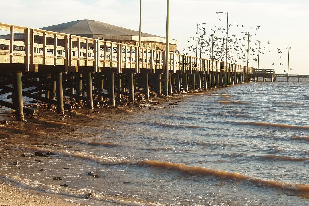
Palacios, Texas
Palacios, originally known as Trespalacios, is a small city located on the Gulf Coast in Matagorda County, Texas. Photograph by Matamaniac.
Bay City, Matagorda County, Texas
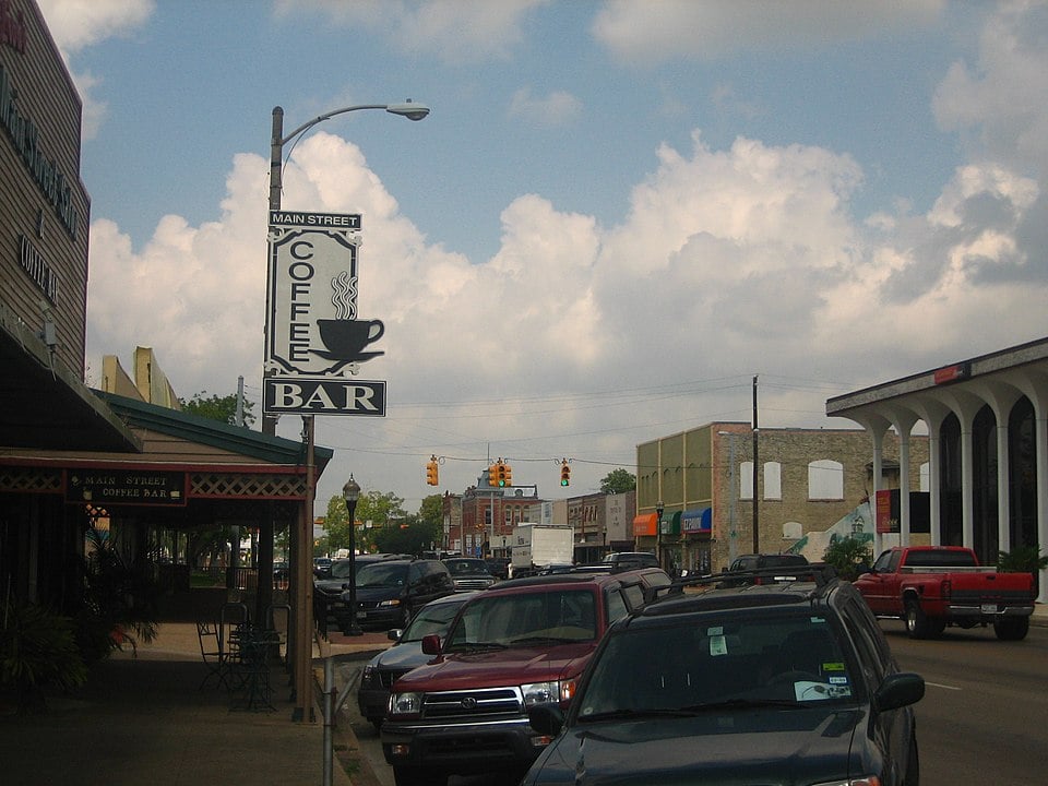
View of the downtown area of Bay City, the seat of Matagorda County, Texas. Photograph by Billy Hathorn.

Proud to call Texas home?
Put your name on the town, county, or lake of your choice.
Search Places »

