Lavaca County

Lavaca County, Texas

Lavaca County, Texas
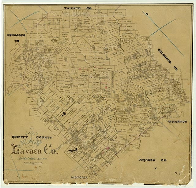
Lavaca County is on U.S. highways 77 and Alternate 90 east of San Antonio in the Claypan area of southeast Central Texas. The center of the county is at approximately 29°25' north latitude and 96°55' west longitude, near the county seat, Hallettsville. The county is bounded on the north by Fayette County, on the east by Colorado and Jackson counties, on the south by Victoria County, and on the west by DeWitt and Gonzales counties. Lavaca County consists of 971 square miles of flat to undulating terrain, with elevations ranging from 150 to 350 feet. The eastern part is drained by the Navidad River, and the central and western parts are drained by the Lavaca River. In the southeast section the soils are light-colored and loamy with very deep reddish or mottled subsoils. The remainder of the county has deep, alkaline, clayey soils over a chalk underlayer with a high shrink-swell potential. The vegetation in the northwest is typical of the Blackland Prairies region, with tall grasses, mesquite, and oak predominating; pecan and elm trees are found along streams. The southeast is in the Post Oak Savannah vegetation area, characterized by tall grasses and post and blackjack oaks. Between 21 and 30 percent of the land is considered prime farmland. Natural resources include oil and natural gas. Among the animals commonly found in the county are white-tail deer, bobcats, coyotes, opossums, squirrels, foxes, armadillos, skunks, bats, cottontail rabbits, raccoons, and numerous reptile, fish, and bird species. The climate is subtropical-humid, with warm summers and mild winters. The average rainfall is thirty-seven inches. The average annual temperature is 70° F; temperatures in January range from an average low of 41° to an average high of 64° and in July from 73° to 96°. The growing season averages 278 days a year, with the last freeze in early March and the first freeze in early December.
The area of Lavaca County has long been the site of human habitation. Numerous artifacts from the Paleo-Indian (10,000–6,000 B.C.) and Archaic (6,000–200 B.C.) periods have been found in the area, which has been more or less continuously occupied for more than 10,000 years. During historic times the region was inhabited by various Coahuiltecan tribes, and Karankawas and Tonkawas were frequent visitors. In the eighteenth and early nineteenth centuries the Lipan Apaches and Comanches occasionally made forays into the region. Most of these peoples eventually succumbed to European diseases, were killed by other Indian tribes, intermarried, or migrated elsewhere; by 1850 virtually no trace of them remained.
Christopher Long | © TSHA
Adapted from the official Handbook of Texas, a state encyclopedia developed by Texas State Historical Association (TSHA). It is an authoritative source of trusted historical records.
- ✅ Adoption Status:
Currently Exists
Yes
Place type
Lavaca County is classified as a County
Altitude Range
85 ft – 503 ft
Size
Land area does not include water surface area, whereas total area does
- Land Area: 969.7 mi²
- Total Area: 970.4 mi²
Temperature
January mean minimum:
41.3°F
July mean maximum:
93.4°F
Rainfall, 2019
41.1 inches
Population Count, 2019
20,154
Civilian Labor Count, 2019
7,925
Unemployment, 2019
6.2%
Property Values, 2019
$4,822,950,058 USD
Per-Capita Income, 2019
$50,919 USD
Retail Sales, 2019
$231,714,071 USD
Wages, 2019
$65,401,231 USD
County Map of Texas
Lavaca County
- Lavaca County
Places of Lavaca County
| Place | Type | Population (Year/Source) | Currently Exists |
|---|---|---|---|
| Town | – | – | |
| Town | – | – | |
| Town | – | – | |
| Town | – | – | |
| Town | – | – | |
| Town | – | – | |
| Town | – | – | |
| Town | – | – | |
| Town | – | – | |
| Town | – | – | |
| Town | 65 (2009) | Yes | |
| Town | – | – | |
| Town | – | – | |
| Town | – | – | |
| Town | – | – | |
| Town | – | – | |
| Town | 55 (2009) | Yes | |
| Town | – | – | |
| Town | – | – | |
| Town | – | – | |
| Town | 78 (2009) | Yes | |
| Town | – | – | |
| Town | – | – | |
| Town | – | – | |
| Town | 40 (2009) | Yes | |
| Town | – | – | |
| Town | 2,742 (2021) | Yes | |
| Town | 88 (2009) | Yes | |
| Town | – | – | |
| Town | 45 (2009) | Yes | |
| Town | – | – | |
| Town | – | – | |
| Town | 75 (2009) | Yes | |
| Town | 45 (2009) | Yes | |
| Town | 75 (2009) | Yes | |
| Town | – | – | |
| Town | – | – | |
| Town | – | – | |
| Town | – | – | |
| Town | – | – | |
| Town | – | – | |
| Town | – | – | |
| Town | 30 (2009) | Yes | |
| Town | 165 (2009) | Yes | |
| Town | 861 (2021) | Yes | |
| Town | – | – | |
| Town | 50 (2009) | Yes | |
| Town | – | – | |
| Town | – | – | |
| Town | – | – | |
| Town | – | – | |
| Town | – | – | |
| Town | – | – | |
| Town | – | – | |
| Town | – | – | |
| Town | – | – | |
| Town | – | – | |
| Town | – | – | |
| Town | – | – | |
| Town | – | – | |
| Town | 2,154 (2021) | Yes | |
| Town | – | – | |
| Town | 60 (2009) | Yes | |
| Town | – | – | |
| Town | 75 (2009) | Yes | |
| Town | 360 (2009) | Yes | |
| Town | – | – | |
| Town | – | – | |
| Town | – | – | |
| Town | 40 (2009) | Yes | |
| Town | 45 (2009) | Yes | |
| Town | – | – | |
| Town | – | – | |
| Town | 65 (2009) | Yes | |
| Town | – | – | |
| Town | 90 (2009) | Yes | |
| Town | 55 (2009) | Yes | |
| Town | – | – | |
| Town | 5,923 (2021) | Yes |
Photos Nearby:

Yoakum, Texas
City of Yoakum, Texas located in both DeWitt and Lavaca Counties. Photograph by Dana Smith.

Hallettsville, Texas
Image of the Hallettsville, Texas City Hall, in Lavaca County, Texas. Photograph credit: TE photos via TexasEscapes.com
Proud to call Texas home?
Put your name on the town, county, or lake of your choice.
Search Places »