Fayette County
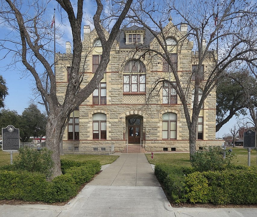
Fayette County, Texas
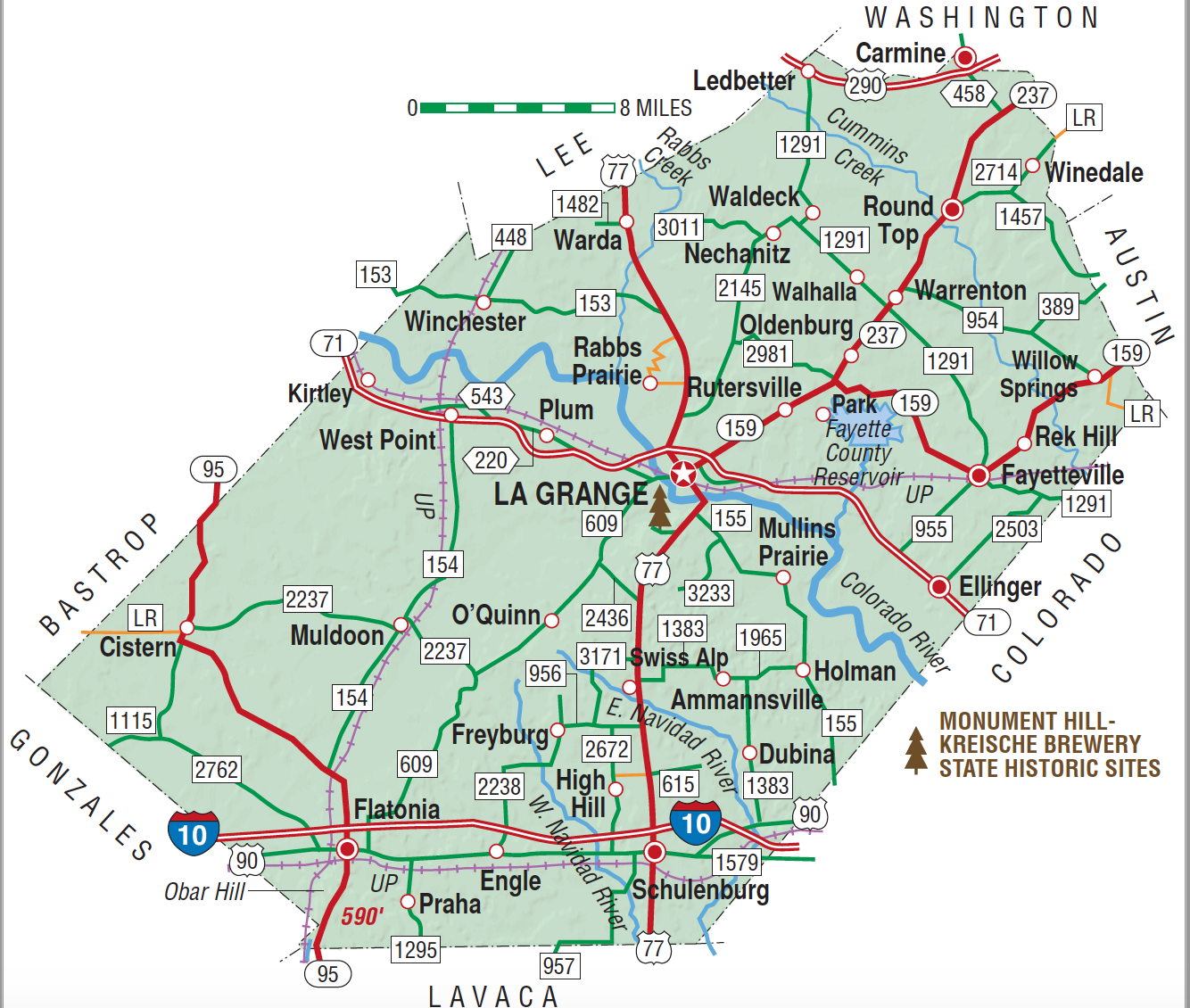
Fayette County, Texas
Fayette County is on Interstate Highway 10 sixty miles southeast of Austin in the Blackland Prairies region of south central Texas. The center of the county lies at 29°55' north latitude and 96°55' west longitude. La Grange is the county seat and largest community. In addition to Interstate 10, transportation needs are served by U.S. highways 77, 90, and 290 and State highways 71, 95, 159, and 237. The county's terrain varies from level land to steep slopes, with altitude ranging from 200 to 600 feet. The Colorado River, which bisects the county from northwest to southeast, is fed by several major creeks: Rabb's, Cedar, and Baylor on the east and Buckner's and Williams on the west. Cummins Creek flows through the eastern part of the county and the East and West Navidad rivers through the southern part. Potable groundwater is readily available from the Carrizo-Wilcox and Catahoula-Oakville aquifers at relatively shallow depths. The county covers 950 square miles and is composed of three land resource areas—Blackland Prairies (63 percent), the Post Oak Belt (30 percent), and the Colorado river bottom (7 percent). Within the Blackland Prairie on the uplands are the clayey blacklands and loamy claypen areas. The bottomlands contain dark loamy and clayey soils. The Post Oak Belt contains the Texas Claypan Area with uplands of gray, slightly acid sandy loam and sandy to clayey bottomland soils. Scattered outcrops of the Willis Formation form gravelly ridges along the Colorado River and large areas of gravelly soils in the northern half of the county. The vegetation is a mixture of the post oak savannah and Blackland Prairie region, with tall grasses, oak, and elms predominating. Also commonly found are eastern red cedars, pecans, cottonwoods, and sycamores. Some hickory, walnut, mesquite, and yaupon grow in diverse areas. The north central section is forested by loblolly pine, a continuation of the Lost Pines Forest of neighboring Bastrop County. Whitetail deer are native to the area, especially in the timbered areas, and raccoon, beaver, and possum live along the many creeks. Coyotes are so numerous that a control program has been instigated. Game species found in this district include squirrel, quail, dove, and water fowl. Southern bald eagles traverse the county, particularly along the Colorado River. Natural resources include timber, lignite, sand, gravel, bleaching clays, volcanic ash, oil, and gas. The climate is subtropical humid, with hot summers and mild winters. The average annual precipitation is thirty-six inches. Temperatures range from an average low of 41° F in January to an average high of 96° in July, and the average growing season is 277 days. Flooding is common along the Colorado River; major floods in 1869, 1870, 1900, 1938, and 1992 caused considerable damage to crops and property.
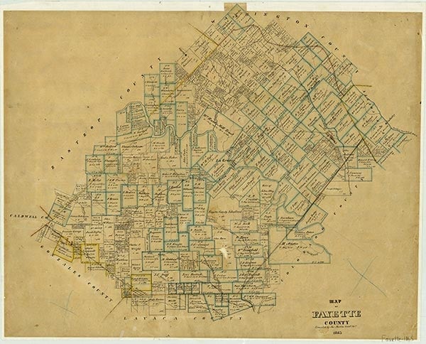
Prior to European settlement Lipan Apaches and Tonkawa Indians inhabited parts of what is now Fayette County. Many Indian artifacts have been found, especially along the Colorado River and near Round Top. A few miles north of the Colorado River, above Little Pin Oak Creek, a stratified multicomponent campsite was found, with Clovis, Plainview, and other later artifacts. In the early eighteenth century Spanish explorers passed through the area. La Bahía Road, which ran southwest to northeast and crossed the river at the site of present La Grange, was the major route for travel during the Mexican period. The area was part of Stephen F. Austin's first colony, but the earliest known White settlers, Aylett C. Buckner and Peter Powell, arrived earlier and lived on La Bahía Road west of La Grange, where they ran a trading post. Formal settlement began in 1822 with the arrival of the Austin colonists. From 1824 to 1828 ten members of the Old Three Hundred received title to their land grants in the fertile Colorado River valley; William Rabb received four leagues in order to build a mill. A total of ninety-two Mexican land grants were granted in the area that is now Fayette County. The earliest settlers gathered at Wood's Fort, Moore's Fort (La Grange), the James Ross home, and Jesse Burnam's blockhouse, twelve miles below La Grange. Burnam's Ferry on the Colorado River provided a cutoff route from La Bahía Road to San Felipe. Prior to Texas independence, the area above La Bahía Road was in the Mina Municipality and the area below in the Municipality of Colorado. Gotier's Trace, the Wilbarger Trace, and the La Grange-San Felipe road intersected La Bahía Road. Ferries were used to cross the Colorado River until the first bridge was built at La Grange by private subscription in 1883. On December 14, 1837, upon petition of the citizens, the Congress of the Republic of Texas established the county of Fayette, named in honor of the Marquis de Lafayette. La Grange, the name of the chateau to which Lafayette retired, was designated the county seat. The citizens organized the county government on January 18, 1838, and the southwestern boundary of the county was extended westward on May 3, 1838. The county lost territory in the south to Lavaca County in 1854 and in the north to Lee County in 1874.
Daphne Dalton Garrett | © TSHA

Adapted from the official Handbook of Texas, a state encyclopedia developed by Texas State Historical Association (TSHA). It is an authoritative source of trusted historical records.
Currently Exists
Yes
Place type
Fayette County is classified as a County
Altitude Range
200 ft – 590 ft
Size
Land area does not include water surface area, whereas total area does
- Land Area: 950.0 mi²
- Total Area: 959.8 mi²
Temperature
January mean minimum:
39.2°F
July mean maximum:
95.5°F
Rainfall, 2019
40.5 inches
Population Count, 2019
25,346
Civilian Labor Count, 2019
11,324
Unemployment, 2019
5.2%
Property Values, 2019
$6,910,143,625 USD
Per-Capita Income, 2019
$53,564 USD
Retail Sales, 2019
$489,599,371 USD
Wages, 2019
$105,173,443 USD
County Map of Texas
Fayette County
- Fayette County
Places of Fayette County
| Place | Type | Population (Year/Source) | Currently Exists |
|---|---|---|---|
| Town | – | – | |
| Town | 137 (2009) | Yes | |
| Town | – | – | |
| Town | – | – | |
| Town | – | – | |
| Town | – | – | |
| Town | – | – | |
| Town | – | – | |
| Town | – | – | |
| Town | – | – | |
| Town | – | – | |
| Town | – | – | |
| Town | 244 (2021) | Yes | |
| Town | – | – | |
| Town | 137 (2009) | Yes | |
| Town | – | – | |
| Town | – | – | |
| Town | – | – | |
| Town | – | – | |
| Town | – | – | |
| Town | – | – | |
| Town | – | – | |
| Town | 272 (2009) | Yes | |
| Town | – | – | |
| Town | 286 (2021) | Yes | |
| Town | – | – | |
| Town | 141 (2009) | Yes | |
| Lake | – | Yes | |
| Town | 246 (2021) | Yes | |
| Town | 1,336 (2021) | Yes | |
| Town | – | – | |
| Town | – | – | |
| Town | – | – | |
| Town | 148 (2009) | Yes | |
| Town | – | – | |
| Town | – | – | |
| Town | – | – | |
| Town | – | – | |
| Town | – | – | |
| Town | – | – | |
| Town | – | – | |
| Town | – | – | |
| Town | – | – | |
| Town | 176 (2009) | Yes | |
| Town | 101 (2009) | Yes | |
| Town | – | – | |
| Town | – | – | |
| Town | – | – | |
| Town | – | – | |
| Town | – | – | |
| Town | – | – | |
| Town | 93 (2009) | Yes | |
| Town | 4,423 (2021) | Yes | |
| Town | 83 (2009) | Yes | |
| Town | – | – | |
| Town | – | – | |
| Town | – | – | |
| Town | – | – | |
| Town | – | – | |
| Town | – | – | |
| Town | – | – | |
| Town | – | – | |
| Town | – | – | |
| Town | – | – | |
| Town | – | – | |
| Town | – | – | |
| Town | 95 (2009) | Yes | |
| Town | 107 (2009) | Yes | |
| Town | – | – | |
| Town | – | – | |
| Town | – | – | |
| Town | 57 (2009) | Yes | |
| Town | – | – | |
| Town | – | – | |
| Town | – | – | |
| Town | 191 (2009) | Yes | |
| Town | – | – | |
| Town | 92 (2009) | Yes | |
| Town | – | – | |
| Town | – | – | |
| Town | – | – | |
| Town | – | – | |
| Town | 25 (2009) | Yes | |
| Town | – | – | |
| Town | – | – | |
| Town | – | – | |
| Town | 582 (2021) | Yes | |
| Town | 90 (2009) | Yes | |
| Town | – | – | |
| Town | – | – | |
| Town | 79 (2009) | Yes | |
| Town | – | – | |
| Town | 168 (2009) | Yes | |
| Town | – | – | |
| Town | – | – | |
| Town | – | – | |
| Town | – | – | |
| Town | 93 (2021) | Yes | |
| Town | – | – | |
| Town | 137 (2009) | Yes | |
| Town | 2,669 (2021) | Yes | |
| Town | – | – | |
| Town | – | – | |
| Town | – | – | |
| Town | – | – | |
| Town | – | – | |
| Town | 17 (2009) | Yes | |
| Town | – | – | |
| Town | – | – | |
| Town | – | – | |
| Town | – | – | |
| Town | – | – | |
| Town | – | – | |
| Town | – | – | |
| Town | – | – | |
| Town | – | – | |
| Town | 34 (2009) | Yes | |
| Town | 38 (2009) | Yes | |
| Town | 121 (2009) | Yes | |
| Town | 186 (2009) | Yes | |
| Town | – | – | |
| Town | – | – | |
| Town | 213 (2009) | Yes | |
| Town | – | – | |
| Town | 74 (2009) | Yes | |
| Town | 232 (2009) | Yes | |
| Town | 67 (2009) | Yes | |
| Town | – | – | |
| Town | – | – | |
| Town | – | – | |
| Town | – | – | |
| Town | – | – |
Photos Nearby:
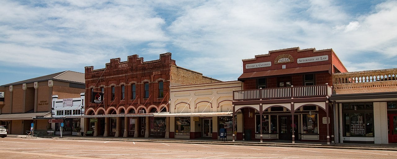
La Grange, Fayette County, Texas
Downtown La Grange, the seat of Fayette County, Texas. Photograph by Renelibrary.
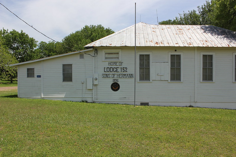
The Sons of Hermann Lodge in Rutersville
Photo by Nicholas Henderson, CC2
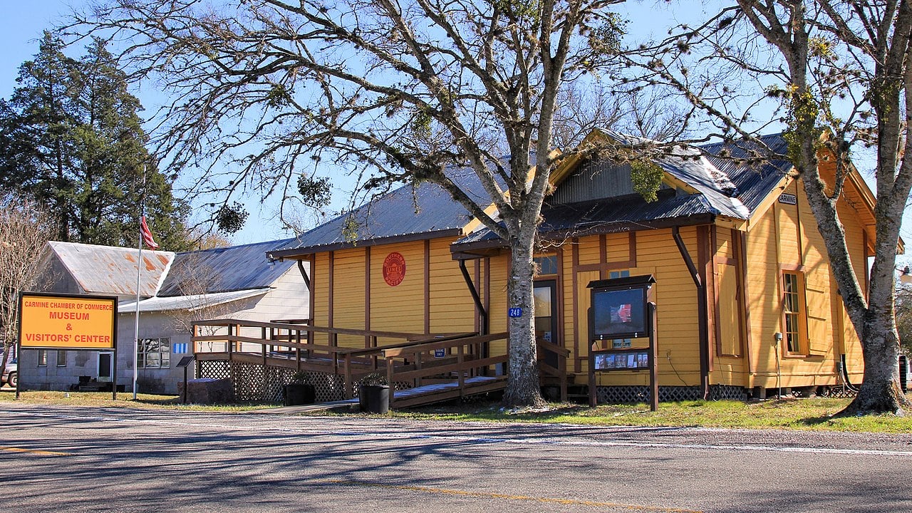
City of Carmine, Fayette County, Texas
Carmine Museum and Visitor Center, a city in Fayette County, Texas. Photograph by Larry D. Moore.
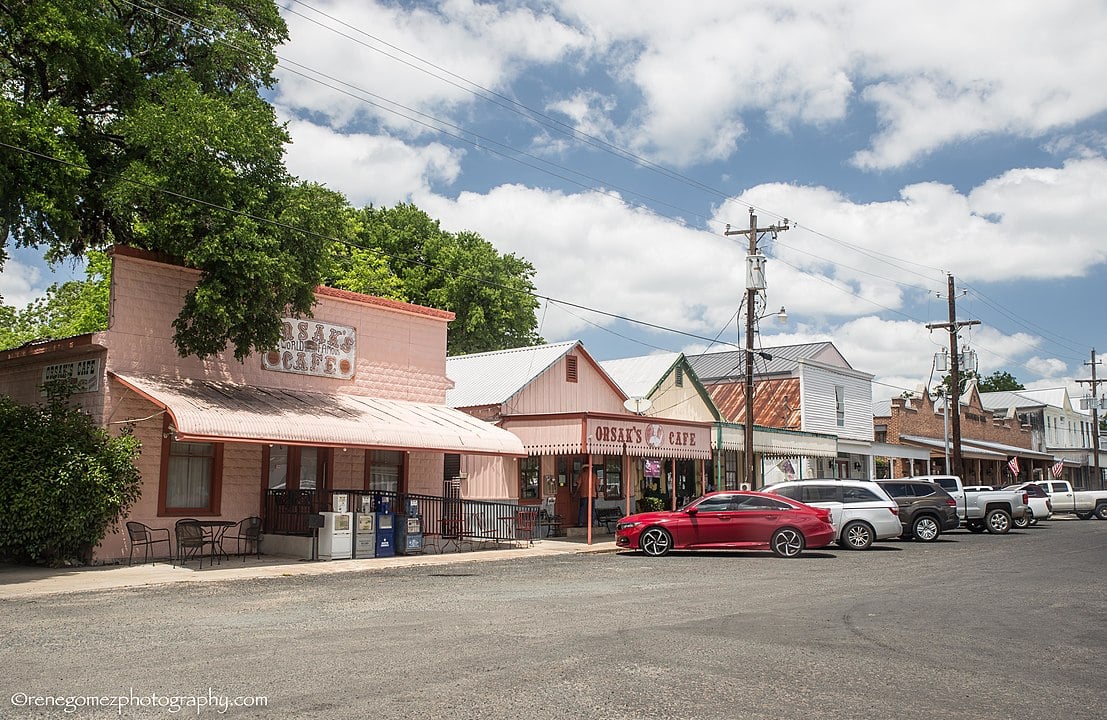
City of Fayetteville, Fayette County, Texas
Downtown view of the City of Fayetteville, Fayette County, Texas. Photograph by Renelibrary.
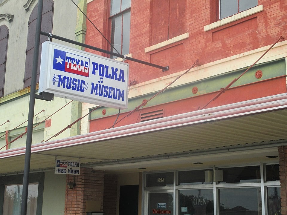
City of Schulenburg, Fayette County, Texas
Texas Polka Dot Music Museum in the City of Schulenburg, Fayette County, Texas. Photograph by Billy Hathorn.

Proud to call Texas home?
Put your name on the town, county, or lake of your choice.
Search Places »

