Concho County

Concho County, Texas

Concho County, Texas
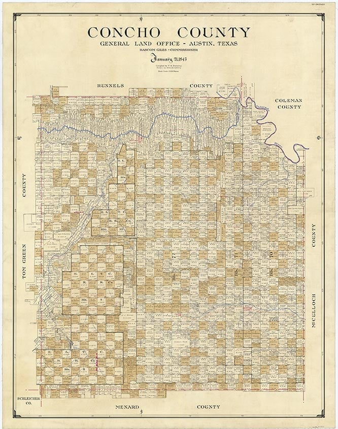
Concho County, in Central Texas, straddles the northern edge of the Edwards Plateau. The county derives its name from the Concho (or "Shell") River, which in turn was named for the large number of mussels found there. The center of the county lies at approximately 31°20' north latitude and 99°52' west longitude. Paint Rock, the county seat, is situated in the north central part of the county on U.S. Highway 83, approximately thirty miles east of San Angelo and 150 miles northwest of Austin. Concho County comprises 992 square miles with an elevation of 1,600 to 2,100 feet above mean sea level. The terrain in the north is rolling, with steep slopes and benches, while that to the south, on the Edwards Plateau, is flat but broken by numerous deep creekbeds. The thin and stony soil of the Edwards Plateau supports oak, juniper, and mesquite, while the clay loams to the north sustain grasses, mixed with oak, juniper, and mesquite in the northwest and with mesquite in the north central region. The county is drained by the Concho River, which flows east to west across the northern part, and by the Colorado River, which forms the northeastern county line. Major creeks, or creek systems, include Dry Hollow, Kickapoo, Duck, Mustang, Brady, and South Brady. The creekbeds were originally thick with elm, live oak, and post oak trees. Of the total county area, 11 to 20 percent is considered to be prime farmland. Temperatures range from an average low of 33° F in January to an average high of 97° in July. Rainfall averages twenty-three inches; snowfall, three inches; and the growing season, 228 days per year. The climate, on the whole, is mild and dry. Natural resources include oil and gas, limestone, caliche, dolomite, and bituminous coal. In 1982, 218,748 barrels of oil and 1,982,444 thousand cubic feet of gas-well gas were produced in the county.
The two sites of Indian activity in Concho County that have drawn the most attention lie along the bluffs of the Concho and Colorado rivers. About a mile west of Paint Rock, above the Concho, are found some of the most noted Indian pictographs in Texas (see PAINT ROCK). To the east of Paint Rock on the Colorado, the area of O. H. Ivie Reservoir has been the scene of the most intensive archeological investigation in the county. Evidence here indicates occupation as early as 10,000 to 8,000 B.C. The area was attractive for its plentiful food, water, and lithic resources, and for the protective high cliffs along the river. The diet of the groups who camped here may have consisted of such plant foods as yucca, prickly pear, mesquite beans, pecans, and grass seeds, as well as fish, mussels, prairie chickens, and wild turkeys. Deer would not have been abundant, and buffalo may not have been generally available until the late Archaic Period (ca. A.D. 1100). In 1981 this area marked the farthest point north that ring middens and burned-rock middens had been discovered.
Mary M. Standifer | © TSHA
Adapted from the official Handbook of Texas, a state encyclopedia developed by Texas State Historical Association (TSHA). It is an authoritative source of trusted historical records.
- ✅ Adoption Status:
Currently Exists
Yes
Place type
Concho County is classified as a County
Altitude Range
1421 ft – 2413 ft
Size
Land area does not include water surface area, whereas total area does
- Land Area: 983.8 mi²
- Total Area: 993.7 mi²
Temperature
January mean minimum:
29.5°F
July mean maximum:
95.2°F
Rainfall, 2019
25.0 inches
Population Count, 2019
2,726
Civilian Labor Count, 2019
1,256
Unemployment, 2019
5.1%
Property Values, 2019
$1,052,036,423 USD
Per-Capita Income, 2019
$19,801 USD
Retail Sales, 2019
$16,478,537 USD
Wages, 2019
$10,777,117 USD
County Map of Texas
Concho County
- Concho County
Places of Concho County
| Place | Type | Population (Year/Source) | Currently Exists |
|---|---|---|---|
| Town | – | – | |
| Town | – | – | |
| Town | 1,543 (2021) | Yes | |
| Town | 215 (2009) | Yes | |
| Town | – | – | |
| Town | – | – | |
| Town | – | – | |
| Town | – | – | |
| Town | – | – | |
| Town | – | – | |
| Town | – | – | |
| Town | – | – | |
| Town | 40 (2009) | Yes | |
| Town | 80 (2009) | Yes | |
| Lake | – | Yes | |
| Town | 350 (2021) | Yes | |
| Town | – | – | |
| Town | – | – | |
| Town | – | – | |
| Town | – | – | |
| Town | 20 (2009) | Yes | |
| Town | – | – | |
| Town | – | – | |
| Town | – | – |
Photos Nearby:

Town of Paint Rock in Concho County, Texas
Concho County Courthouse in the town of Paint Rock, the seat of Concho County, Texas. Photograph by Aulliso.

Stones in O.H. Ivie Reservoir
Photo by Jonathan Cutrer, jcutrer.com
Proud to call Texas home?
Put your name on the town, county, or lake of your choice.
Search Places »