Washington County
.jpg)
Washington County, Texas

Washington County, Texas

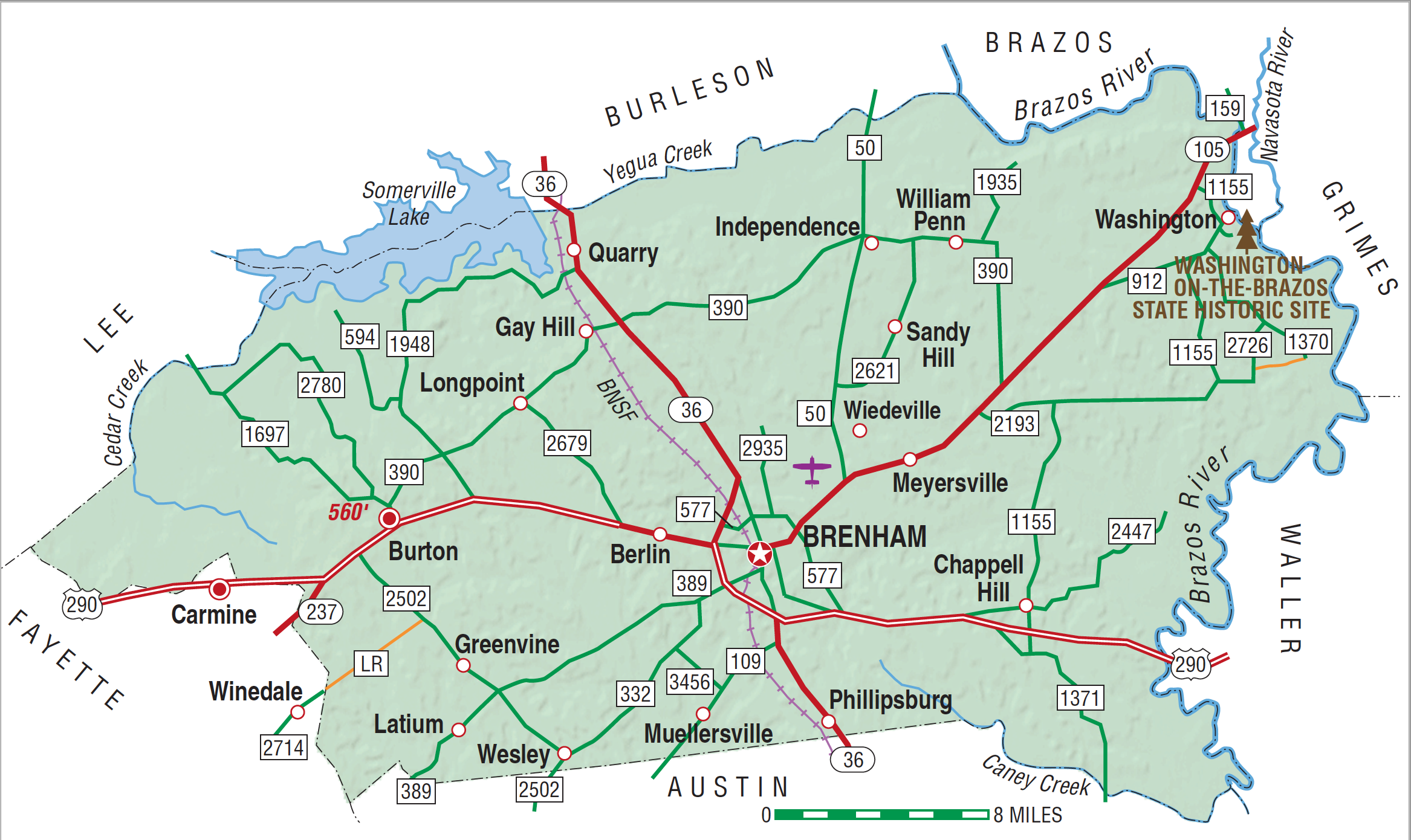
Washington County is in the Blackland Prairies region of southeast central Texas. The center of the county is at 30°14' north latitude and 96°24' west longitude. Brenham, the seat of government, is near the county's center and seventy-five air miles east of Austin. The county was named for George Washington, the first president of the United States. Washington County encompasses 611 square miles of gently rolling land with elevations ranging between 200 to 500 feet above sea level. Sloping generally southeasterly, the area drains into the Brazos River, which runs along the eastern border. Other prominent streams include New Year's Creek, East Fork Mill Creek, Doe Run Creek, Wolf Creek, and Yegua Creek, which forms the county's northern border. Soils along the Brazos River are brownish to reddish, cracking and clayey or loamy; in most of the rest of the county, shallow to deep clayey soils cover a bed of chalk. Subterranean water reservoirs include the Catahoula, Oakville, and Lagarto formations. Washington County, located in the post oak belt, is well timbered, and elms, ashes, hackberries, hickories, pecans, cottonwoods, red cedar, mulberry, and other trees grow in its forests. The county's climate is subtropical and humid, with an average annual precipitation of forty inches. Temperatures range from an average low of 39° F in January to an average high of 96° F in July; the growing season lasts 277 days. The principle mineral resources include oil, natural gas, lignite, brick clay, salt and sulphur. The county is linked to the rest of the state by U.S. Highway 290, which crosses east to west, and by the Burlington Northern Santa Fe Railroad, which runs north-south.
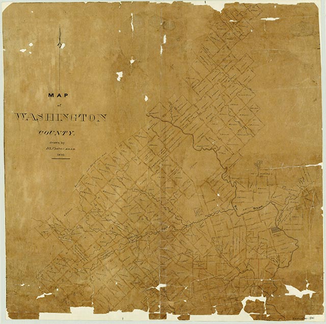
Artifacts from the Paleo-Indian culture have been found in the area that is now Washington County, indicating that it has been occupied by humans for perhaps 9,000 years or more. Early Indian residents most likely included the Tamique and Xaraname tribes, who inhabited the prairie between the Tonkawas of Central Texas and the coastal-dwelling Karankawas. Early frontiersmen found Tonkawas living in permanent settlements in the central portion of the area that is now Washington County and encountered transient Arananamus and Apaches in the area. Frenchmen led by René Robert Cavelier, Sieur de La Salle, were likely the first Europeans to cross the area of present Washington County. In reaction to French incursions into territory claimed by Spain, the Spanish established the earliest Texas presidio in East Texas near Nacogdoches. Later, after the relocation of the La Bahía mission to Goliad, the Spanish constructed a road through what is now Washington County to connect these two settlements. The area remained unsettled by Europeans until 1821, when settlers recruited by Stephen F. Austin moved into the region. According to Austin's colonization plan, participating families would receive 640 acres for the head of the household, 320 acres for the wife, and 100 acres for each child. Slaveholders would receive an additional 80 acres for each slave possessed. Many, though not all, of the Old Three Hundred colonists settled in what is now Washington County. In November 1821 Andrew Robinson, accompanied by Abner, Joseph, and Robert Kuykendall, crossed to the west side of the Brazos River with their families. From there Abner Kuykendall and Thomas Boatwright moved some ten miles west, establishing farms on New Year's Creek in January 1822. Other early settlers to the area included James Gray, Abner Robinson, John P. Coles, and William Gates and his sons, Amos, Samuel, and Charles. A ferry began operation across the Brazos River near its confluence with the Navasota in 1822, and in 1825 a cotton gin was established in the area. Washington (usually known as Washington-on-the-Brazos), the county's first community, arose at the site of the ferry. By the mid-1830s the town had grown to become a commercial center for the area.
James L. Hailey, John Leffler | © TSHA

Adapted from the official Handbook of Texas, a state encyclopedia developed by Texas State Historical Association (TSHA). It is an authoritative source of trusted historical records.

- ✅ Adoption Status:
- This place is available for adoption! Available for adoption!
- Adopted by:
- Your name goes here
- Dedication Message:
- Your message goes here
Currently Exists
Yes
Place type
Washington County is classified as a County
Altitude Range
150 ft – 560 ft
Size
Land area does not include water surface area, whereas total area does
- Land Area: 604.0 mi²
- Total Area: 621.8 mi²
Temperature
January mean minimum:
39.0°F
July mean maximum:
94.2°F
Rainfall, 2019
45.1 inches
Population Count, 2019
35,882
Civilian Labor Count, 2019
14,645
Unemployment, 2019
6.5%
Property Values, 2019
$6,929,801,168 USD
Per-Capita Income, 2019
$52,265 USD
Retail Sales, 2019
$536,144,558 USD
Wages, 2019
$167,888,485 USD
County Map of Texas
Washington County
- Washington County
Places of Washington County
| Place | Type | Population (Year/Source) | Currently Exists |
|---|---|---|---|
| Town | – | – | |
| Town | – | – | |
| Town | – | – | |
| Town | – | – | |
| Town | 40 (2009) | Yes | |
| Town | 18,117 (2021) | Yes | |
| Town | – | – | |
| Town | 283 (2021) | Yes | |
| Town | – | – | |
| Town | – | – | |
| Town | – | – | |
| Town | – | – | |
| Town | – | – | |
| Town | 750 (2009) | Yes | |
| Town | – | – | |
| Town | – | – | |
| Town | – | – | |
| Town | – | – | |
| Town | – | – | |
| Town | – | – | |
| Town | – | – | |
| Town | – | – | |
| Town | – | – | |
| Town | – | – | |
| Town | – | – | |
| Town | 40 (2009) | Yes | |
| Town | – | – | |
| Town | – | – | |
| Town | – | – | |
| Town | 35 (2009) | Yes | |
| Town | – | – | |
| Town | – | – | |
| Town | – | – | |
| Town | 140 (2009) | Yes | |
| Town | – | – | |
| Town | – | – | |
| Town | – | – | |
| Town | – | – | |
| Town | 20 (2009) | Yes | |
| Town | – | – | |
| Town | – | – | |
| Town | – | – | |
| Town | – | – | |
| Town | – | – | |
| Town | 30 (2009) | Yes | |
| Town | 30 (2009) | Yes | |
| Town | – | – | |
| Town | – | – | |
| Town | – | – | |
| Town | 15 (2009) | Yes | |
| Town | 40 (2009) | Yes | |
| Town | – | – | |
| Town | – | – | |
| Town | – | – | |
| Town | 20 (2009) | Yes | |
| Town | – | – | |
| Town | – | – | |
| Town | – | – | |
| Town | – | – | |
| Town | – | – | |
| Town | – | – | |
| Town | 75 (2009) | Yes | |
| Town | – | – | |
| Town | – | – | |
| Town | – | – | |
| Town | 20 (2009) | Yes | |
| Town | 60 (2009) | Yes | |
| Town | – | – | |
| Town | 20 (2009) | Yes | |
| Town | – | – | |
| Town | – | – | |
| Town | – | – | |
| Town | 50 (2009) | Yes | |
| Town | – | – | |
| Lake | – | Yes | |
| Town | – | – | |
| Town | – | – | |
| Town | – | – | |
| Town | – | – | |
| Town | – | – | |
| Town | – | – | |
| Town | – | – | |
| Town | – | – | |
| Town | – | – | |
| Town | – | – | |
| Town | – | – | |
| Town | 100 (2009) | Yes | |
| Town | – | – | |
| Town | 65 (2009) | Yes | |
| Town | – | – | |
| Town | – | – | |
| Town | 25 (2009) | Yes | |
| Town | 35 (2009) | Yes | |
| Town | 40 (2009) | Yes | |
| Town | – | – | |
| Town | – | – |
Photos Nearby:

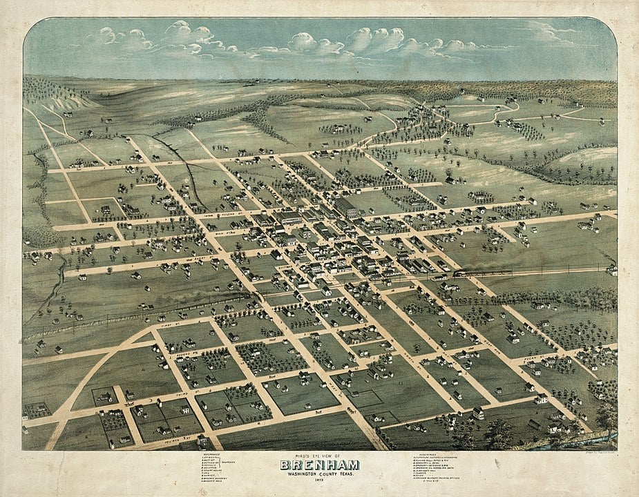
Brenham, Texas
Historic Aereal Map of Brenham, Texas from 1873. Brenham is the seat of Washington County, Texas. Photograph Credit: Augustus Koch via Wikipedia.
.jpg)
Cormorants on Somerville Lake
Photo by Beverly Moseley, USDA NRCS Texas, Public Domain

Proud to call Texas home?
Put your name on the town, county, or lake of your choice.
Search Places »
