Saragosa
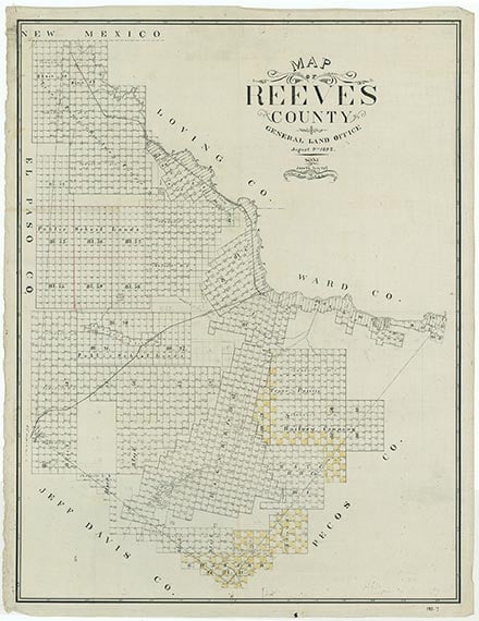
Saragosa is on State Highway 17 and Farm Road 1215 near Toyah Creek two miles north of Interstate Highway 10 in southeastern Reeves County. It began as a farming community in 1880 when fifteen families settled on Toyah Creek four miles east of its present site. Antonio Matta built the headquarters for his horse ranch there. The town had a hotel, a restaurant, and a saloon. A post office opened in 1884 and closed in 1891. By 1899 Saragosa reported two schools with twenty-nine students and one teacher at the present site of the community. A post office was reestablished in 1900. During the 1900–01 school term Saragosa operated three school districts, in which one employed one teacher for twenty-one students, the second had eight students and one teacher, and the third had three students and one teacher. In April 1909 the town plat for Saragosa was filed at the county courthouse. The Pecos Valley Southern Railway built its tracks through town in 1911. Saragosa had a population of twenty-five in 1925 and 150 in 1931. In 1933 it had twenty-five again, but as many as six businesses operated there during the 1930s. Throughout the 1940s the community had sixty people and four businesses. From 1949 until 1960 the population was ninety. At the end of the 1950s Saragosa had nine businesses. The 1960 census set population for Saragosa at 380; in 1970 it was 173. Twelve business operated in 1961, but only nine were reported in 1964. Although population was stable at 183 at the end of the 1980s, the last business had closed by 1980. On the night of May 22, 1987, Saragosa was hit by a violent, multiple-vortex tornado. Thirty of the 183 inhabitants were killed, and 121 were injured. The storm cut a half-mile-wide path through the village and destroyed 85 percent of its structures. Total damage was $1.3 million. By the early 1990s Saragosa had rebuilt. The population was reported at 185 in 1990. The population remained the same in 2000.
Julia Cauble Smith | © TSHA
Adapted from the official Handbook of Texas, a state encyclopedia developed by Texas State Historical Association (TSHA). It is an authoritative source of trusted historical records.
- ✅ Adoption Status:
- This place is available for adoption! Available for adoption!
- Adopted by:
- Your name goes here
- Dedication Message:
- Your message goes here
Belongs to
Saragosa is part of or belongs to the following places:
Currently Exists
Yes
Place type
Saragosa is classified as a Town
Associated Names
- [2]
Location
Latitude: 31.02403400Longitude: -103.66156830
Has Post Office
Yes
Is Incorporated
No
Population Count, 2009
185