Mullin
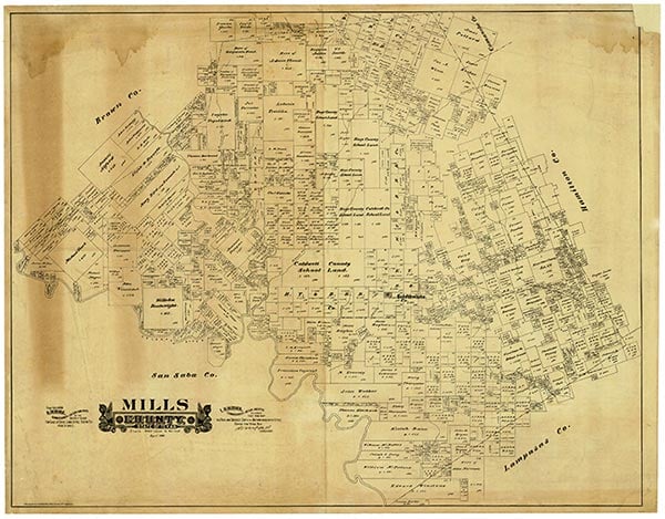
Mullin, on Mullin Creek, U.S. Highway 84/183, Farm Road 573, and the Santa Fe line, ten miles north of Goldthwaite in west central Mills County, became a townsite with the construction of the Santa Fe track through the area in the late 1880s. Both the creek and the town were named for a pioneer family. Among the first businesses in the area were a saloon and a hotel in 1885. Dr. W. D. Kirkpatrick donated the townsite in return for the construction of the railroad through the area. The population of Mullin was 100 in 1890; in 1894 the first permanent schoolhouse was built. A gristmill and cotton gin were among the early businesses. By 1910 the town had three churches, a bank, a weekly newspaper named the Enterprise, and 750 residents. The population fell to 558 by 1920 and 404 by 1947. In 1958 there were only two stores left in the community. The population was 213 in 1980, 194 in 1990 and 175 in 2000.
William R. Hunt | © TSHA
Adapted from the official Handbook of Texas, a state encyclopedia developed by Texas State Historical Association (TSHA). It is an authoritative source of trusted historical records.
- ✅ Adoption Status:
Belongs to
Mullin is part of or belongs to the following places:
Currently Exists
Yes
Place type
Mullin is classified as a Town
Associated Names
- (The Switch)
Location
Latitude: 31.55525290Longitude: -98.66563100
Has Post Office
Yes
Is Incorporated
Yes
Population Count, 2021 View more »
131