Swisher County

Swisher County, Texas

Swisher County, Texas
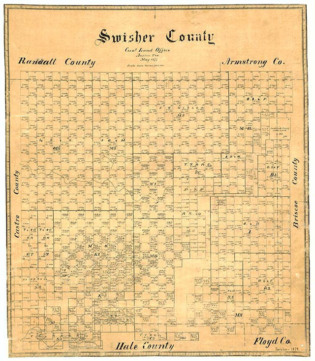
Swisher County is in the transition area between the South Plains and the Panhandle, bordered on the east by Briscoe County, on the south by Hale and Floyd counties, on the west by Castro County, and on the north by Randall and Armstrong counties. The center of the county lies at 34°33' north latitude and 100°47' west longitude. Tulia, the county seat, is near the center of the county, seventy miles north of Lubbock and forty-five miles south of Amarillo. The area was named for James Gibson Swisher, a veteran of the Texas Revolution. Swisher County occupies 896 square miles of level plains broken only by Tule Creek and its three branches, North, Middle, and South Tule draws. These intermittent streams have no appreciable effect on the terrain until they converge into Tule Creek in the eastern part of the county. In the 1940s North Tule Draw was dammed to impound a small earthen reservoir; in 1974 Mackenzie Dam was completed on Tule Creek in the eastern part of the county, and Mackenzie Reservoir began to form. This lake, made to provide a municipal water supply for Silverton, Lockney, Tulia, and Floydada, became a major recreational facility as well. The soils of Swisher County range from alluvial silts to sandy types mixed with disintegrated rock to form an easily worked earth rich in humus. This soil supports an abundant variety of native grasses as well as wheat, corn, grain sorghum, and cotton crops. The county ranges in elevation from 3,000 to 3,600 feet above sea level, averages 18.94 inches of rain per year, and has an annual growing season averaging 205 days. The average minimum temperature is 24° F in January, and the average maximum is 93° in July. The coldest temperature ever recorded in Texas, -23° F, occurred in Tulia on February 12, 1899.
The area that is now Swisher County was long the homeland of Apachean cultures, who were displaced by the more warlike Comanches by around 1700. The Comanches ruled the High Plains until they were crushed by the United States Army in the Red River War of 1874. During this war army troops crisscrossed Swisher County in pursuit of the Comanches, but no significant combat occurred in the county. However, after the battle of Palo Duro Canyon in late September 1874, the power of the Comanches was broken, and by the mid-1870s buffalo hunters were in the county exterminating the herds. In 1876 the Texas state legislature carved Swisher County from lands previously assigned to the Young and Bexar districts. In 1880 four people were reported living in the area. Ranching came to the county as the buffalo were eliminated. Swisher County remained largely unsettled until the JA Ranch of Charles Goodnight expanded into the county in 1883. This activity led to Goodnight's Tule Ranch, which occupied the entire eastern part of the county. By the late 1880s the scattered residents of the county perceived a need for a local government, and a petition for organization was circulated in June 1890. An election held on July 17 formally organized the county with Tulia, a tiny settlement, chosen as county seat. Swisher County remained wholly a ranching county almost until the beginning of the twentieth century; as late as 1890 there were only 535 "improved" acres on the county's seventeen ranches, and only 100 people lived in the area. By the late 1890s, however, a trickle of settlers began to take up school lands and begin stock-farming operations. The availability of good underground water at shallow depths meant that windmills could make any stock-farmer successful. By 1900 there were 186 ranches and farms in the area, and the population had increased to 1,227. More than 34,000 cattle were reported in the county that year. Few crops were grown in the area at that time—only twenty-five acres were planted in cotton—but farming grew steadily during the early twentieth century, especially after the introduction of rail service to the area. A Santa Fe Railroad branch line from Amarillo reached Swisher County in 1906 and later connected the county to Plainview in Hale County. When the line was completed to Lubbock in 1910, Tulia and Swisher County were on a major north-south rail line. Railroad construction also led to the establishment of two Swisher County towns, Happy and Kress, which became new population centers on the railroad.
Donald R. Abbe, John Leffler | © TSHA
Adapted from the official Handbook of Texas, a state encyclopedia developed by Texas State Historical Association (TSHA). It is an authoritative source of trusted historical records.
- ✅ Adoption Status:
Currently Exists
Yes
Place type
Swisher County is classified as a County
Altitude Range
3160 ft – 3735 ft
Size
Land area does not include water surface area, whereas total area does
- Land Area: 890.2 mi²
- Total Area: 900.7 mi²
Temperature
January mean minimum:
22.0°F
July mean maximum:
91.9°F
Rainfall, 2019
21.6 inches
Population Count, 2019
7,397
Civilian Labor Count, 2019
2,423
Unemployment, 2019
5.6%
Property Values, 2019
$732,798,417 USD
Per-Capita Income, 2019
$41,977 USD
Retail Sales, 2019
$51,529,245 USD
Wages, 2019
$19,166,080 USD
County Map of Texas
Swisher County
- Swisher County
Places of Swisher County
| Place | Type | Population (Year/Source) | Currently Exists |
|---|---|---|---|
| Town | – | – | |
| Town | – | – | |
| Town | – | – | |
| Town | – | – | |
| Town | 20 (2009) | Yes | |
| Town | 85 (2009) | Yes | |
| Town | – | – | |
| Town | – | – | |
| Town | – | – | |
| Town | – | – | |
| Town | 613 (2021) | Yes | |
| Town | – | – | |
| Town | – | – | |
| Town | – | – | |
| Town | 608 (2021) | Yes | |
| Town | – | – | |
| Town | – | – | |
| Town | – | – | |
| Town | – | – | |
| Town | – | – | |
| Town | – | – | |
| Town | – | – | |
| Town | – | – | |
| Town | – | – | |
| Town | – | – | |
| Town | 4,474 (2021) | Yes | |
| Town | – | – | |
| Town | – | – | |
| Town | 36 (2009) | Yes | |
| Town | – | – | |
| Town | – | – | |
| Town | – | – | |
| Town | – | – |
Proud to call Texas home?
Put your name on the town, county, or lake of your choice.
Search Places »