Panola County

.jpg)
Panola County, Texas

Panola County, Texas
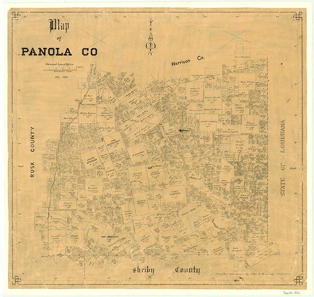
Panola County is in northeastern Texas, bordered on the east by Louisiana, on the south by Shelby County, on the west by Rusk County, and on the north by Harrison County. The center of the county lies at 32°10' north latitude and 94°20' west longitude. Carthage, the county seat, is twenty-six miles south of Marshall, sixty-five miles southeast of Tyler, and fifty miles north of Nacogdoches. The name Panola is derived from ponolo, the Cherokee word for "cotton." Located in the East Texas Timberlands region, Panola County covers 842 square miles of gentle rolling plains and small hills drained by the Sabine River, which cuts across the county diagonally from northwest to southeast. Trees in the county include short-leaf and loblolly pine, oak, maple, hickory, elm, and gum, as well as wild fruit trees such as the plum or sloe and flowering trees such as dogwood, redbud, magnolia, cedar, and holly. Scenic trails pass through 4,000 acres of timberland owned by the International Paper Company. The woodland, once densely populated with small game, now supports deer, squirrel, and quail hunting in season. New stocks of wild turkey have been placed in local forests, but they are still protected from hunters. Freshwater lakes include Hendrick's Lake, Hill's Lake, Clear Lake, and Fish Lake. Reservoirs built in recent years include Murvaul Lake, Martin Lake, and Toledo Bend. The soil is largely sandy loam with clay subsoil. Annual rainfall in Panola County averages 43.9 inches; temperatures range from an average low of 34° F in January to an average high of 94° in July. The growing season lasts 240 days. The county derives much of its income from the extraction of oil, gas, and coal; in 1990, 1,356,000 barrels of crude oil were produced in the county. Other industries include sawmills, poultry and egg processing, and the manufacture of plastic products.
When the European powers raced for claims in the New World early in the seventeenth century, Spain secured its claim to Texas from the Sabine River to the south and west. France also claimed the area, based on the explorations of René Robert Cavelier, Sieur de La Salle. Spain established a line of protected missions across East Texas, two of them not far south of Panola County. The area was involved in a series of territorial disputes between the United States and Spain and Mexico. In 1806, after the United States bought Louisiana from France, a boundary dispute between the United States and Spain was temporarily resolved by the Neutral Ground agreement, but after the Mexican War of Independence, another treaty had to be negotiated between Mexico and the United States. Two confederations of Indians, the Caddos and the Hasinais, lived in the Panola County area, with the Sabine River marking the approximate dividing line between them. The two allied confederations were known as the Timber Tribes. They made permanent homes in farming villages, where they raised grain and vegetables and hunted for small game in the forests. Burial mounds left behind by these people were once visible in the county, but that evidence of aboriginal life in the area has disappeared. Early settlers entered the area by traveling on the Red River or along the trails known as the Old San Antonio Road and Trammel's Trace. Trammel's Trace had originated long before as an Indian trail and later became the route used by trader Nicholas Trammel; it eventually became the western boundary of Panola County. The earliest known White settlement in the area was established by Daniel Martin in 1833. The Martins came to Texas from Missouri intending to join the colony founded by Stephen F. Austin, but after traveling down Trammel's Trace, they camped on a hill near a creek, west of the site of present Beckville. Deciding to stop there, they built a small fort and set up a trading post; the creek became known as Martin's Creek. A second settlement was established near the site of present of Clayton by Rev. Isaac Reed and a large group of relatives. Reed led the settlers to the place and purchased land from Manuel Antonio Romero. Because Mexican colonization laws prohibited settlement within a strip of land twenty leagues wide along the United States boundary, it was 1835 before Anglo settlers in the area could secure land titles from Mexico. But after the Texas Revolution in 1836, the area experienced a great land rush. In 1837 the LaGrone Settlement was established east of the Sabine River near the Louisiana border. The LaGrones' wagon train had passed through the area in 1832, but due to Indian unrest the family had traveled further into Texas; after Texas won its independence, they returned to an appealing spot they had found previously. By 1840 at least forty-nine families were established in the area that became Panola County. The majority came from Tennessee, North Carolina, South Carolina, and Alabama. Some brought slaves with them to Texas; by 1846, according to local tax records, there were 574 slaves in the area.
Leila B. LaGrone | © TSHA
Adapted from the official Handbook of Texas, a state encyclopedia developed by Texas State Historical Association (TSHA). It is an authoritative source of trusted historical records.
- ✅ Adoption Status:
- This place is available for adoption! Available for adoption!
- Adopted by:
- Your name goes here
- Dedication Message:
- Your message goes here
Currently Exists
Yes
Place type
Panola County is classified as a County
Altitude Range
172 ft – 548 ft
Size
Land area does not include water surface area, whereas total area does
- Land Area: 801.8 mi²
- Total Area: 821.3 mi²
Temperature
January mean minimum:
35.2°F
July mean maximum:
93.0°F
Rainfall, 2019
51.4 inches
Population Count, 2019
23,194
Civilian Labor Count, 2019
10
Unemployment, 2019
9.0%
Property Values, 2019
$4,278,566,440 USD
Per-Capita Income, 2019
$43,508 USD
Retail Sales, 2019
$262,279,747 USD
Wages, 2019
$104,311,397 USD
County Map of Texas
Panola County
- Panola County
Places of Panola County
| Place | Type | Population (Year/Source) | Currently Exists |
|---|---|---|---|
| Town | – | – | |
| Town | 12 (2009) | Yes | |
| Town | – | – | |
| Town | – | – | |
| Town | – | – | |
| Town | – | – | |
| Town | – | – | |
| Town | – | – | |
| Town | 736 (2021) | Yes | |
| Town | – | – | |
| Town | 50 (2009) | Yes | |
| Town | – | – | |
| Town | – | – | |
| Town | – | – | |
| Town | – | – | |
| Town | – | – | |
| Town | – | – | |
| Town | – | – | |
| Town | – | – | |
| Town | 40 (2009) | Yes | |
| Town | – | – | |
| Town | – | – | |
| Town | – | – | |
| Town | 95 (2009) | Yes | |
| Town | – | – | |
| Town | – | – | |
| Town | – | – | |
| Town | 6,533 (2021) | Yes | |
| Town | – | – | |
| Town | – | – | |
| Town | 125 (2009) | Yes | |
| Town | – | – | |
| Town | – | – | |
| Town | – | – | |
| Town | – | – | |
| Town | 75 (2009) | Yes | |
| Town | – | – | |
| Town | – | – | |
| Town | 106 (2009) | Yes | |
| Town | 200 (2009) | Yes | |
| Town | 45 (2009) | Yes | |
| Town | – | – | |
| Town | 35 (2009) | Yes | |
| Town | – | – | |
| Town | – | – | |
| Town | – | – | |
| Town | 80 (2009) | Yes | |
| Town | – | – | |
| Town | – | – | |
| Town | – | – | |
| Town | – | – | |
| Town | – | – | |
| Town | 40 (2009) | Yes | |
| Town | 71 (2009) | Yes | |
| Town | – | – | |
| Town | 338 (2021) | Yes | |
| Town | – | – | |
| Town | – | – | |
| Town | 115 (2009) | Yes | |
| Town | – | – | |
| Town | – | – | |
| Town | – | – | |
| Town | – | – | |
| Town | – | – | |
| Town | – | – | |
| Town | – | – | |
| Town | – | – | |
| Town | 40 (2009) | Yes | |
| Town | – | – | |
| Town | 200 (2009) | Yes | |
| Town | – | – | |
| Town | – | – | |
| Town | – | – | |
| Town | – | – | |
| Town | – | – | |
| Town | 60 (2009) | Yes | |
| Town | – | – | |
| Town | 300 (2009) | Yes | |
| Lake | – | Yes | |
| Town | – | – | |
| Town | – | – | |
| Town | – | – | |
| Town | – | – | |
| Town | 40 (2009) | Yes | |
| Town | 150 (2009) | Yes | |
| Town | – | – | |
| Town | – | – | |
| Town | – | – | |
| Lake | – | Yes | |
| Town | – | – | |
| Town | – | – | |
| Town | – | – | |
| Town | 30 (2009) | Yes | |
| Town | – | – | |
| Town | – | – | |
| Town | 150 (2009) | Yes | |
| Town | – | – | |
| Town | – | – | |
| Town | – | – | |
| Town | – | – | |
| Town | – | – | |
| Town | 65 (2009) | Yes | |
| Town | – | – | |
| Town | – | – | |
| Town | – | – | |
| Town | – | – | |
| Town | 150 (2009) | Yes | |
| Town | – | – | |
| Town | 83 (2009) | Yes | |
| Town | – | – | |
| Town | – | – | |
| Town | 305 (2009) | Yes | |
| Town | – | – | |
| Town | – | – | |
| Town | – | – | |
| Town | – | – | |
| Town | – | – | |
| Town | – | – | |
| Town | – | – | |
| Town | – | – | |
| Town | 50 (2009) | Yes | |
| Town | – | – | |
| Town | 125 (2009) | Yes | |
| Town | – | – | |
| Town | – | – | |
| Town | – | – | |
| Town | – | – | |
| Town | 45 (2009) | Yes | |
| Town | – | – | |
| Town | – | – | |
| Town | – | – | |
| Town | – | – | |
| Town | – | – | |
| Town | – | – | |
| Town | – | – | |
| Town | – | – | |
| Town | – | – | |
| Town | 1,340 (2021) | Yes | |
| Town | – | – | |
| Town | – | – | |
| Town | – | – | |
| Lake | – | Yes | |
| Town | – | – | |
| Town | – | – | |
| Town | – | – | |
| Town | – | – | |
| Town | 125 (2009) | Yes | |
| Town | – | – | |
| Town | – | – | |
| Town | – | – | |
| Town | – | – | |
| Town | – | – | |
| Town | – | – | |
| Town | 65 (2009) | Yes | |
| Town | – | – | |
| Town | – | – | |
| Town | – | – | |
| Town | – | – | |
| Town | – | – |
Photos Nearby:

Beckville, Texas
The library and Museum that serves the city of Beckville, in Panola County, Texas Photograph by Barclay Gibson via TexasEscapes.com.

Carthage, Texas
View of Anderson Park in the City of Carthage, in Panola County, Texas, and part of the city's downtown area. Photograph by Michael Barera.
.jpg)

The state park at Martin Creek Lake has canoes available for rent
Photo by Larry D. Moore, CC by SA 4

Toledo Bend Reservoir runs along the Texas–Louisiana border
Photo by Chrismiceli, Public Domain
Proud to call Texas home?
Put your name on the town, county, or lake of your choice.
Search Places »