Henderson County

Henderson County, Texas

Henderson County, Texas
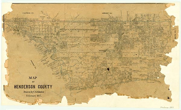
Henderson County is located in East Texas between the Neches and Trinity Rivers. Athens, the largest city and county seat, is near the geographical center of the county (at 32°10' N, 95°50' W), about sixty miles southeast of Dallas on U.S. Highway 175, at the intersection of State highways 31 and 19. Henderson County is in a transitional region between East and Central Texas. Two major lakes are partly in the county: Cedar Creek Reservoir on the northwest and Lake Palestine on the southeast. The county encompasses 949.7 square miles and has different land-resource areas that run almost parallel to the two river boundaries in a northwesterly to a southeasterly direction. The eastern third of the county, along the Neches River, is part of the East Texas Timberlands. This region has wooded, rolling terrain surfaced by deep sandy loams and sands. Loblolly and shortleaf pine, sweet gum, post oak, southern red oak, white oak, and flowering dogwoods grow in this region. In some areas within this system one finds long-leaf pine, black gum, and blackjack oak. Woody undergrowth consists of American beautyberry, greenbriar, and hawthorns. West and parallel to this region is the claypan area, where the soils are shallow sandy loams that overlie dense, clayey subsoils; vegetation here consists of mixed pine and hardwoods, including oak, elm, hackberry, and pecan. Along the Trinity River, the western border of the county, lie the bottomlands of the flood plain, where the vegetation features mixed hardwoods and a dense undergrowth of scrubs and vines typical of the East Texas mixed forests. Throughout these regions are native grasses that include little and big bluestem, Indian grass, switch grass, grama, and Virginia wild rye. A large variety of wildlife and game animals inhabits these areas. The county is hilly and rolling, with an elevation from 256 to 763 feet above sea level. The western part drains into the Trinity River, and the eastern section drains into the Neches River. Mineral resources include oil and gas reserves, sulfur, lignite coal, sand and gravel, and clay used for making bricks and pottery. The climate is considered subtropical. Temperatures range from an average range in July and August of 72° F to 96° and in January of 34° to 56°, for an average annual temperature of 65°. The average annual rainfall is forty inches, and the growing season extends to 260 days. The average date of the last freeze is March 11, and the first freeze is around November 26. Because of its favorable climate, the county's recreation areas are popular retirement centers.
Indians inhabited the area in prehistoric times. Pottery found buried amid fossil remains of extinct horses and camels in the 1920s and 1930s indicated that an aboriginal culture existed along the Trinity River thousands of years ago. One particular artifact, Malakoff Man, is a sandstone mask weighing ninety-eight pounds. When the first Europeans entered the area in the sixteenth century, they found the Hasinais, a Caddoan group, living along the upper Neches River. The Caddoes had the highest cultural development of any Texas Indians. They were agriculturalists and raised corn, beans, squash, sunflowers, and tobacco. Men and women shared garden work, used dogs for hunting bears, consumed small mammals, fish, and birds, ran trot lines baited with doughbait, and gathered nuts, berries, and wild fruits. The Spanish and French explorers described these people, who called themselves the Tejas, as friendly (see TEXAS, ORIGIN OF NAME).
Linda S. Hudson | © TSHA
Adapted from the official Handbook of Texas, a state encyclopedia developed by Texas State Historical Association (TSHA). It is an authoritative source of trusted historical records.
- ✅ Adoption Status:
- This place is available for adoption! Available for adoption!
- Adopted by:
- Your name goes here
- Dedication Message:
- Your message goes here
Currently Exists
Yes
Place type
Henderson County is classified as a County
Altitude Range
256 ft – 763 ft
Size
Land area does not include water surface area, whereas total area does
- Land Area: 873.8 mi²
- Total Area: 948.3 mi²
Temperature
January mean minimum:
34.5°F
July mean maximum:
92.6°F
Rainfall, 2019
42.9 inches
Population Count, 2019
82,737
Civilian Labor Count, 2019
35,673
Unemployment, 2019
7.6%
Property Values, 2019
$7,646,643,920 USD
Per-Capita Income, 2019
$39,627 USD
Retail Sales, 2019
$903,016,739 USD
Wages, 2019
$180,288,923 USD
County Map of Texas
Henderson County
- Henderson County
Places of Henderson County
| Place | Type | Population (Year/Source) | Currently Exists |
|---|---|---|---|
| Town | – | – | |
| Town | – | – | |
| Town | – | – | |
| Town | 45 (2009) | Yes | |
| Town | – | – | |
| Town | – | – | |
| Town | – | – | |
| Town | – | – | |
| Town | 12,890 (2021) | Yes | |
| Town | 150 (2009) | Yes | |
| Town | – | – | |
| Town | 852 (2021) | Yes | |
| Town | 125 (2009) | Yes | |
| Town | – | – | |
| Town | – | – | |
| Town | 1,229 (2021) | Yes | |
| Town | – | – | |
| Town | – | – | |
| Town | 188 (2021) | Yes | |
| Town | – | – | |
| Town | 20 (2014) | Yes | |
| Town | – | – | |
| Lake | – | Yes | |
| Town | – | – | |
| Town | – | – | |
| Town | 3,400 (2021) | Yes | |
| Town | – | – | |
| Town | 244 (2021) | Yes | |
| Town | – | – | |
| Town | – | – | |
| Town | 180 (2009) | Yes | |
| Town | 160 (2009) | Yes | |
| Town | – | – | |
| Town | – | – | |
| Town | – | – | |
| Town | 354 (2021) | Yes | |
| Town | 1,153 (2021) | Yes | |
| Town | – | – | |
| Town | 75 (2009) | Yes | |
| Town | – | – | |
| Town | – | – | |
| Lake | – | Yes | |
| Town | – | – | |
| Town | – | – | |
| Town | – | – | |
| Town | – | – | |
| Town | – | – | |
| Town | – | – | |
| Town | – | – | |
| Town | 6,378 (2021) | Yes | |
| Town | – | – | |
| Town | – | – | |
| Town | – | – | |
| Town | – | – | |
| Town | – | – | |
| Town | – | – | |
| Town | – | – | |
| Town | – | – | |
| Lake | – | Yes | |
| Lake | – | Yes | |
| Town | 250 (2009) | Yes | |
| Town | 50 (2009) | Yes | |
| Town | – | – | |
| Town | – | – | |
| Town | – | – | |
| Town | – | – | |
| Town | 749 (2021) | Yes | |
| Town | – | – | |
| Town | – | – | |
| Town | 4,562 (2021) | Yes | |
| Town | – | – | |
| Town | 2,219 (2021) | Yes | |
| Town | – | – | |
| Town | – | – | |
| Town | 30 (2009) | Yes | |
| Town | – | – | |
| Town | – | – | |
| Town | – | – | |
| Town | – | – | |
| Town | – | – | |
| Town | 159 (2021) | Yes | |
| Town | – | – | |
| Town | – | – | |
| Town | 523 (2021) | Yes | |
| Town | – | – | |
| Town | – | – | |
| Town | – | – | |
| Town | – | – | |
| Town | – | – | |
| Town | 60 (2009) | Yes | |
| Town | – | – | |
| Town | – | – | |
| Town | – | – | |
| Town | 750 (2021) | Yes | |
| Town | – | – | |
| Town | 20 (2009) | Yes | |
| Town | – | – | |
| Town | – | – | |
| Town | – | – | |
| Town | – | – | |
| Town | – | – | |
| Town | 288 (2021) | Yes | |
| Town | – | – | |
| Town | – | – | |
| Town | – | – | |
| Town | 120 (2009) | Yes | |
| Town | – | – | |
| Town | – | – | |
| Town | – | – | |
| Town | 1,402 (2021) | Yes | |
| Town | – | – | |
| Town | – | – | |
| Town | 300 (2009) | Yes | |
| Town | – | – | |
| Town | 501 (2021) | Yes | |
| Town | – | – | |
| Town | – | – | |
| Town | – | – | |
| Town | – | – | |
| Town | – | – | |
| Town | – | – | |
| Town | 536 (2021) | Yes | |
| Town | – | – | |
| Town | – | – | |
| Town | – | – | |
| Town | – | – | |
| Town | – | – | |
| Town | 65 (2009) | Yes | |
| Town | 2,212 (2021) | Yes | |
| Town | 861 (2021) | Yes | |
| Lake | – | Yes | |
| Town | – | – | |
| Town | – | – | |
| Town | – | – | |
| Town | – | – | |
| Town | – | – | |
| Town | – | – | |
| Town | – | – | |
| Town | – | – | |
| Town | – | – |
Photos Nearby:

Athens, Texas
The City Hall in the Athens, the seat of Henderson County, Texas. Photograph by Billy Hathorn.

Brownsboro, Texas
Brownsboro Highschool in Brownsboro, a city located in northeastern Henderson County. Photograph by Billy Hathorn.

Murchison, Texas
Murchison, a city in Henderson County, Texas. Photo by Will Roberts on Unsplash.

Eustace, Texas
Eustace, is located in northwestern Henderson County, Texas. Image credit: Barclay Gibson, 2006, for TexasEscapes.com.

Coffee City, Texas
Coffee Landing Restaurant in Coffee City, a town located in southeastern Henderson County. Photograph by WCFireChief for Wikimapia..

Chandler, Texas
Main Library in the City of Chandler, located in the northeast corner of Henderson County, Texas. Photograph by Billy Hathorn.

Gun Barrell City, Texas
Gun Barrell City is located in northwestern Henderson County, on the eastern shore of Cedar Creek Lake. Image Credit: John Stankewitz for TexasEscapes.com.

A view of the park on the shore of Lake Athens
Photo by Nicholas Henderson, Flickr, CC2

The dam at Trinidad Lake
Photo by Madeleine LaFerney, Flickr, CC2

A spillway on Lake Palestine
Photo by ImageTek, Flickr, CC2
Proud to call Texas home?
Put your name on the town, county, or lake of your choice.
Search Places »