Fort Bend County

Fort Bend County, Texas

Fort Bend County, Texas
Fort Bend County is in the coastal plains of southeastern Texas. Richmond, the county seat, at 29°35' north latitude and 95°45' west longitude, is twenty-eight miles west-southwest of Houston and at the approximate center of the county. The county comprises 869 square miles of level to slightly rolling terrain with an elevation ranging from eighty to 250 feet above sea level. Temperatures range from an average high of 94° F in July to an average low of 44° in January; rainfall averages slightly more than forty-five inches a year, and the growing season lasts 296 days. The Brazos River flows diagonally northwest to southeast through the county and drains the broad central valley via numerous creeks and bayous. The San Bernard River, which forms the west boundary, drains the western quarter of the county. Major streams include Big Creek, which flows east into the Brazos River; Oyster Creek, which winds parallel to and east of the Brazos River; and Buffalo Bayou, which rises in the northern tip of the county and flows east into Harris County. Soils vary from rich alluvial in the Brazos valley to sandy loams and clay on the prairies. Native trees include pecan, oak, ash, and cottonwood; there are some timberlands in the north and along streams. Mineral resources include natural gas, oil, and sulfur; sand, clay, and gravel are also produced in commercial quantities.
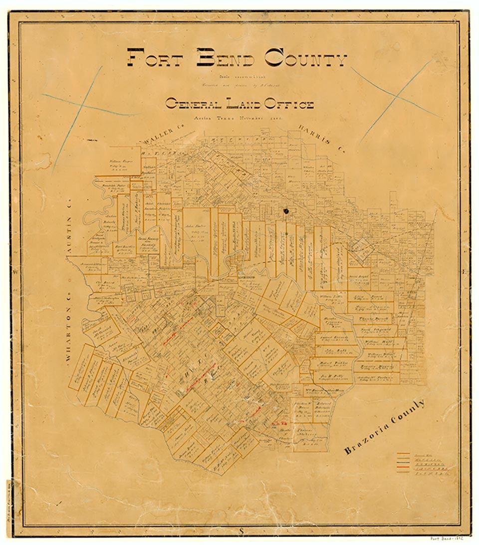
The settlement of Fort Bend County began in the early 1820s as part of the Anglo-American colonization of Texas under the auspices of the Spanish government. Authorization to settle 300 families in the valleys of the Brazos and Colorado rivers was initially granted to Moses Austin, but plans were delayed by his death in June 1821 and Mexican independence from Spain. Stephen F. Austin assumed the responsibility of leadership from his father and gained confirmation of the original Spanish grants from the newly established Mexican government in 1823. Following arrangements with Austin, a group of colonists sailed from New Orleans in November 1821 on the schooner Lively and anchored near the mouth of the Brazos River on the Texas coast. In 1822 a small party of men from this group left the ship and traveled inland some ninety miles and, on a bluff near a deep bend in the river, built a two-room cabin. As the settlement grew, the cabin became known as both Fort Settlement and Fort Bend; the latter name, in time, prevailed. In 1824 the Mexican government issued documents officially granting to the colonists their leagues of land. Of the 297 grants, fifty-three were issued to Fort Bend settlers (see OLD THREE HUNDRED). The presence of the Karankawa Indians near the new colonial settlements proved to be a comparatively minor problem. The first settlers had a few skirmishes, but as the colonies increased, the Karankawas began moving out of the area and by the 1850s had migrated as far south as Mexico.
Virginia Laird Ott | © TSHA
Adapted from the official Handbook of Texas, a state encyclopedia developed by Texas State Historical Association (TSHA). It is an authoritative source of trusted historical records.
- ✅ Adoption Status:
Adopted by:
Alan Sandersen
In honor of retired Sheriff Milton Wright
Until: April 17th, 2025
Currently Exists
Yes
Place type
Fort Bend County is classified as a County
Altitude Range
46 ft – 158 ft
Size
Land area does not include water surface area, whereas total area does
- Land Area: 861.5 mi²
- Total Area: 885.3 mi²
Temperature
January mean minimum:
44.1°F
July mean maximum:
94.9°F
Rainfall, 2019
50.4 inches
Population Count, 2019
811,688
Civilian Labor Count, 2019
385,787
Unemployment, 2019
9.0%
Property Values, 2019
$85,053,198,282 USD
Per-Capita Income, 2019
$57,540 USD
Retail Sales, 2019
$8,598,868,230 USD
Wages, 2019
$2,693,630,795 USD
County Map of Texas
Fort Bend County
- Fort Bend County
Places of Fort Bend County
| Place | Type | Population (Year/Source) | Currently Exists |
|---|---|---|---|
| Town | – | – | |
| Town | 2,156 (2021) | Yes | |
| Lake | – | Yes | |
| Town | – | – | |
| Town | 599 (2021) | Yes | |
| Town | – | – | |
| Town | – | – | |
| Town | 50 (2014) | Yes | |
| Town | – | – | |
| Town | – | – | |
| Town | – | – | |
| Town | 18,399 (2021) | Yes | |
| Town | – | – | |
| Town | – | – | |
| Town | – | – | |
| Town | – | – | |
| Town | – | – | |
| Town | – | – | |
| Town | – | – | |
| Town | – | – | |
| Town | 1,642 (2021) | Yes | |
| Town | – | – | |
| Town | – | – | |
| Town | – | – | |
| Town | – | – | |
| Town | – | – | |
| Town | – | – | |
| Town | – | – | |
| Town | – | – | |
| Town | – | – | |
| Town | 921 (2021) | Yes | |
| Town | – | – | |
| Town | – | – | |
| Town | 1,397 (2021) | Yes | |
| Town | – | – | |
| Town | – | – | |
| Town | – | – | |
| Town | – | – | |
| Town | – | – | |
| Town | 11,133 (2021) | Yes | |
| Town | – | – | |
| Town | 23,921 (2021) | Yes | |
| Town | – | – | |
| Town | 25,169 (2021) | Yes | |
| Town | – | – | |
| Town | – | – | |
| Town | – | – | |
| Town | – | – | |
| Town | 239 (2014) | Yes | |
| Town | – | – | |
| Town | – | – | |
| Town | – | – | |
| Town | – | – | |
| Town | – | – | |
| Town | – | – | |
| Town | – | – | |
| Town | – | – | |
| Town | – | – | |
| Town | – | – | |
| Town | 2,288,250 (2021) | Yes | |
| Town | – | – | |
| Town | – | – | |
| Town | 100 (2014) | Yes | |
| Town | 24,005 (2021) | Yes | |
| Town | 342 (2021) | Yes | |
| Town | – | – | |
| Town | – | – | |
| Town | – | – | |
| Town | – | – | |
| Town | – | – | |
| Town | – | – | |
| Town | – | – | |
| Town | – | – | |
| Town | 4,671 (2021) | Yes | |
| Town | 38,772 (2021) | Yes | |
| Town | – | – | |
| Town | 74,850 (2021) | Yes | |
| Town | – | – | |
| Town | – | – | |
| Town | – | – | |
| Town | – | – | |
| Town | – | – | |
| Town | 3,062 (2021) | Yes | |
| Town | – | – | |
| Town | 315 (2021) | Yes | |
| Town | – | – | |
| Town | – | – | |
| Town | 125,990 (2021) | Yes | |
| Town | – | – | |
| Town | 19,944 (2021) | Yes | |
| Town | – | – | |
| Town | – | – | |
| Town | – | – | |
| Town | 1,031 (2021) | Yes | |
| Town | – | – | |
| Town | – | – | |
| Town | – | – | |
| Town | – | – | |
| Town | – | – | |
| Town | 12,233 (2021) | Yes | |
| Town | – | – | |
| Town | 39,468 (2021) | Yes | |
| Town | – | – | |
| Town | – | – | |
| Town | – | – | |
| Town | 22,980 (2021) | Yes | |
| Town | 642 (2021) | Yes | |
| Town | – | – | |
| Town | – | – | |
| Lake | – | Yes | |
| Town | – | – | |
| Town | 17,364 (2021) | Yes | |
| Town | 109,373 (2021) | Yes | |
| Town | – | – | |
| Town | – | – | |
| Town | – | – | |
| Town | 163 (2021) | Yes | |
| Town | – | – | |
| Town | – | – | |
| Town | – | – | |
| Town | 4,061 (2021) | Yes | |
| Town | – | – | |
| Town | – | – | |
| Town | – | – | |
| Town | – | – | |
| Town | 190 (2014) | Yes |
Photos Nearby:

Houston, Texas
Houston, Texas Photo by Efrain Alonso from Pexels

Richmond, Texas
View of the Forth Bend County Courthouse in Richmond, Texas the seat of the county. Photograph by Larry D. Moore.

Stafford, Texas
Stafford, Texas Photo by Alisa Matthews on Unsplash

The water of Smithers Lake is used for cooling an electric plant
Photo by the Texas state government, public domain

The Barker Reservoir spillway flooded after Hurricane Ike in 2008
Photo by karllehenbaur, Flickr, CC2
Proud to call Texas home?
Put your name on the town, county, or lake of your choice.
Search Places »