Armstrong County

Armstrong County, Texas

Armstrong County, Texas
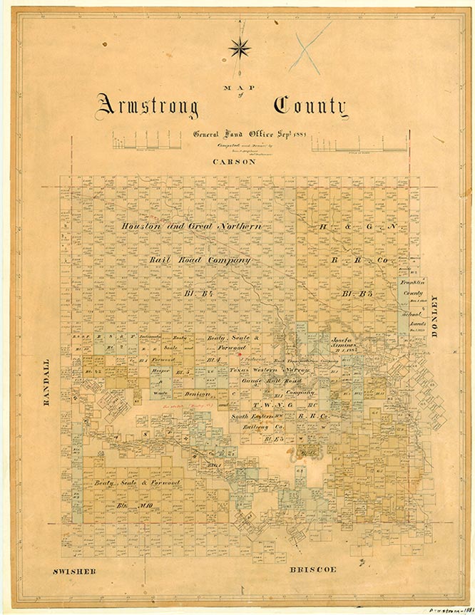
Armstrong County, in the central Panhandle on the eastern edge of the Texas High Plains, is bounded on the east by Donley County, on the north by Carson County, on the west by Randall County, and on the south by Swisher and Briscoe counties. It is named for one of several pioneer Texas families named Armstrong, though the sources are unclear about which one. The center of the county lies approximately at 34°58' north latitude and 101°20' west longitude. Claude, the county seat, is in the north central part of the county thirty miles east of Amarillo. Armstrong County occupies 907 square miles of level plains and canyons. The northern half is generally level, as is the far southwest corner. The rest of the southern half of the county is covered by the great Palo Duro Canyon. The eastern end of Palo Duro Canyon State Scenic Park is in Armstrong County. The soil surface of rich deep gray and chocolate loams supports abundant native grasses as well as wheat and grain sorghums in some areas. The county is crossed by three streams, the Prairie Dog Town Fork of the Red River in Palo Duro Canyon, the Salt Fork of the Red River, and Mulberry Creek, all of which run year-round to some degree. Elevation ranges from 2,300 to 3,500 feet, and the average rainfall is 19.98 inches per year. The average minimum temperature is 19°F in January, and the average maximum is 92° in July. The growing season averages 213 days per year.
The Panhandle was occupied by Paleo-Indians perhaps as early as 10,000 B.C. The Apaches were supplanted by the Comanches around A.D. 1700, when the area became a part of the Comanche homelands; Palo Duro Canyon was a favorite haunt of the Comanches. After the Comanche incursion, some Kiowa and Cheyenne Indians also moved into the area. Anglo-Americans have been resident here only since the 1870s. The Red River War of 1874 led to the final removal of the Comanches to American Indian Territory. The campaign culminated in the battle of Palo Duro Canyon, fought on both sides of the present Randall-Armstrong county line. With the American Indian threat removed, ranchers soon arrived.
Donald R. Abbe | © TSHA
Adapted from the official Handbook of Texas, a state encyclopedia developed by Texas State Historical Association (TSHA). It is an authoritative source of trusted historical records.
- ✅ Adoption Status:
Currently Exists
Yes
Place type
Armstrong County is classified as a County
Altitude Range
2300 ft – 3535 ft
Size
Land area does not include water surface area, whereas total area does
- Land Area: 909.1 mi²
- Total Area: 913.8 mi²
Temperature
January mean minimum:
22.4°F
July mean maximum:
90.6°F
Rainfall, 2019
22.3 inches
Population Count, 2019
1,887
Civilian Labor Count, 2019
867
Unemployment, 2019
4.6%
Property Values, 2019
$793,708,310 USD
Per-Capita Income, 2019
$47,995 USD
Retail Sales, 2019
$16,201,450 USD
Wages, 2019
$4,605,353 USD
County Map of Texas
Armstrong County
- Armstrong County
Places of Armstrong County
| Place | Type | Population (Year/Source) | Currently Exists |
|---|---|---|---|
| Town | – | – | |
| Town | – | – | |
| Town | – | – | |
| Town | – | – | |
| Town | 1,184 (2021) | Yes | |
| Town | – | – | |
| Town | 10 (2014) | Yes | |
| Town | 20 (2009) | Yes | |
| Town | – | – | |
| Town | – | – | |
| Town | – | – | |
| Town | – | – | |
| Town | – | – | |
| Town | – | – | |
| Town | – | – | |
| Town | – | – | |
| Town | – | – | |
| Town | 10 (2014) | Yes | |
| Town | – | – | |
| Town | 227 (2021) | Yes | |
| Town | 25 (2014) | Yes |
Proud to call Texas home?
Put your name on the town, county, or lake of your choice.
Search Places »