Snyder

Snyder, Texas

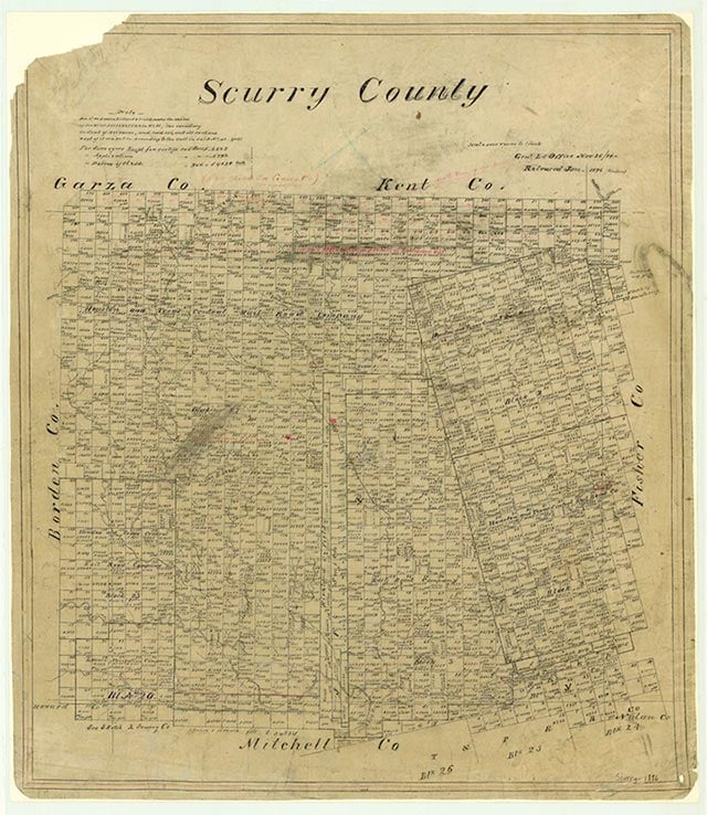
Snyder, the county seat of Scurry County, is at the junction of U.S. highways 84 and 180, eighty-seven miles southeast of Lubbock in the central part of the county. It had its beginnings in 1878, when a buffalo hunter and trader, William Henry (Pete) Snyder, a native of Pennsylvania, built a trading post on the banks of Deep Creek. Other hunters were attracted to the post, and a colony of buffalo-hide dwellings grew up around it. These dwellings, as well as the occasionally dubious character of their inhabitants, gave the town its first names, "Hide Town," and "Robber's Roost." In 1882 Snyder drew up a town plan and invited immigration. The first public school was established sometime that year. In 1884, when Scurry County was organized, Synder's settlement was chosen as the county seat. By 1892 Snyder had a population of 600, two churches, two banks, a steam gin, a gristmill, and two weekly newspapers, the Scurry County Citizen and the Coming West. Construction began on the Roscoe, Snyder and Pacific Railway in 1907, the same year that Snyder's city charter was granted. In 1911 the Atchison, Topeka and Santa Fe Railway laid tracks through Snyder. By 1910, the first year census figures were recorded for Snyder, the town had a population of 2,514. A women's literary circle, the Altrurian Club, was formed in 1908, and eventually spawned eight more study clubs. While the public school system was still developing, these clubs performed significant educational functions; later their focus changed to public service. Snyder remained a farming and ranching community until 1948, when oil was discovered on the Canyon Reef formation north of town. Within a year the population jumped from around 4,000 to over 12,000, a tent and trailer city sprang up on the town's northern edge. The boom was over by late 1951, and the population, which had peaked at around 16,000, stabilized at 11,000. Snyder was left an ugly city with many vacant or half-completed buildings. During the 1960s city officials began refurbishing, and in 1964 a long-range planning committee improved opportunities for low-income citizens. By 1968 in a contest cosponsored by the National Municipal League and Look Magazine, the city was named one of only eleven All-American cities in the United States. Large industries located in Snyder during the late 1960s and the early 1970s, and its population began to rise again. By 1960 Snyder had seven elementary schools, two junior highs, and a high school. Until 1965 black children were forced to attend a separate facility, the Abraham Lincoln School, which had only eight grades. If they wished to attend high school, they were told to go to San Antonio. In 1969 a long string of failed attempts finally culminated in the approval of a proposal for a junior college, and in the fall of 1971 the new Western Texas College opened with 649 students. In 1986 enrollment was over 1,000. The Diamond M Foundation was established in 1950 by oilman and rancher Clarence T. McLaughlin to collect works of American artists. The Diamond M Museum opened in 1964 and five years later doubled in size. In 1990 it housed over eighty bronzes and 200 paintings, including works by Andrew Wyeth and Peter Hurd, and is considered among the best collections in Texas. In 1980 Snyder had a population of 12,705. The Snyder Daily News has been published since 1950. Oil has remained important to the city's economy. In the late 1960s Scurry County became the leading oil-producing county in Texas as the result of a locally developed method of injecting carbon dioxide into the formation to increase the pressure and thereby increase the yield. In 1973 Scurry oil companies recovered their billionth barrel of oil. In 1987 ranching and cotton farming also continued to employ a large part of the population. In 1990 the population was 12,195. The population dropped to 10,783 in 2000.
Noel Wiggins | © TSHA
Adapted from the official Handbook of Texas, a state encyclopedia developed by Texas State Historical Association (TSHA). It is an authoritative source of trusted historical records.
- ✅ Adoption Status:
- This place is available for adoption! Available for adoption!
- Adopted by:
- Your name goes here
- Dedication Message:
- Your message goes here
Belongs to
Snyder is part of or belongs to the following places:
Currently Exists
Yes
Place type
Snyder is classified as a Town
Associated Names
- (Hidetown)
- (Robber's Roost)
Location
Latitude: 32.71380660Longitude: -100.91120000
Has Post Office
Yes
Is Incorporated
Yes
Population Count, 2021 View more »
11,264
Places of Snyder
| Place | Type | Population (Year/Source) | Currently Exists |
|---|---|---|---|
| College or University | – | Yes |
Proud to call Texas home?
Put your name on the town, county, or lake of your choice.
Search Places »